Why WA’s Murchison GeoRegion Is Perfect For A Winter Road Trip
Words and photos by Cassie Wilkins.
While the GeoRegion Trail itself covers 21 sites of natural and cultural significance, many of these are not actually open to the public. So instead, we’ve created our own self-drive road trip itinerary looping from Perth up to Meekatharra and back again, showcasing the remote and rugged beauty of the region and its ancient red landscape, long shaped by the flora, fauna and people who have walked this part of the earth for tens of thousands of years.
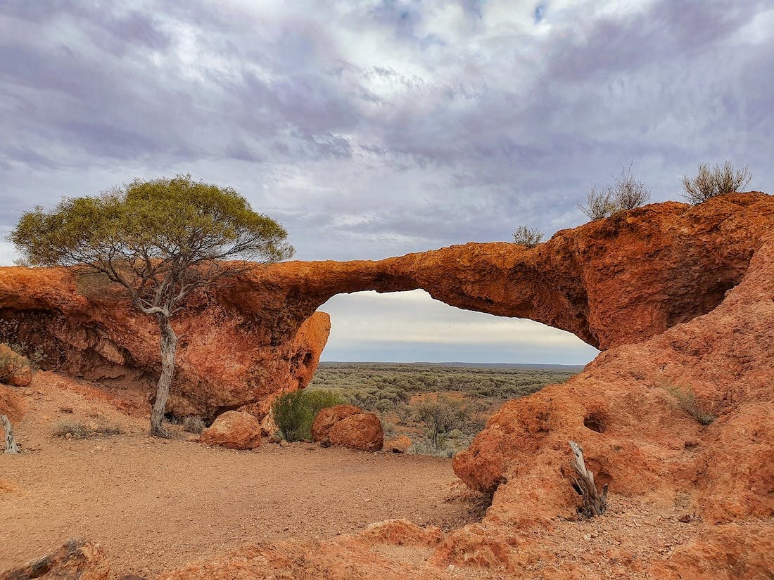
London Bridge, Sandstone
WHAT IS IT?
Australia’s first ever geotourism development, the Murchison GeoRegion was created in 2020 to celebrate the ABC – Abiotic: non-alive, like landscapes and geology, Biotic: alive, like flowers, plants, wildlife and biodiversity, and Cultural: human – and the interconnectedness of their story that has shaped the Murchison region since time literally began, 4.5 billion years ago.
In fact, Jack Hills – which is closed to the public so is unfortunately not on this trip – is home to the oldest substance ever found on earth; a 4.4 billion-year-old zircon crystal. Wowee! Still, you’ll see billions-year-old mega-rocks and meteorites and all sorts of other cool things.
WHERE YOU’LL GO
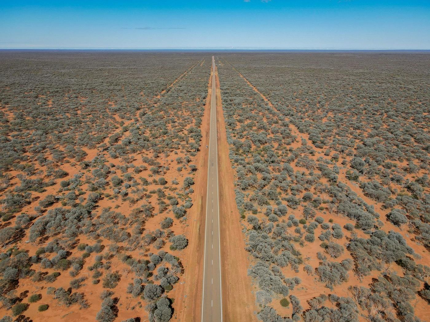
This self-drive loop runs up the Great Northern Highway as far north as Meekatharra and then follows dirt roads back down again, melding the Miners Pathway with the best (accessible) sites in the Murchison GeoRegion along the way. It’s a trip for lovers of the golden outback, endless horizons, starry night skies, wildflowers, geology and history – with ghost towns, Aboriginal rock art and quirky old buildings aplenty.
While we’ve created it as a 5-day loop, you can take it as slow as you like, or speed through – though you might struggle to do the full 1800 km in any less than four days. It can also be tailored as a one-way trip up on the inland route to Karijini National Park and Port Hedland, with lots of interesting places to stop on the way.
Walga Rock, Australia’s second-largest monolith after Uluru
WHEN TO GO
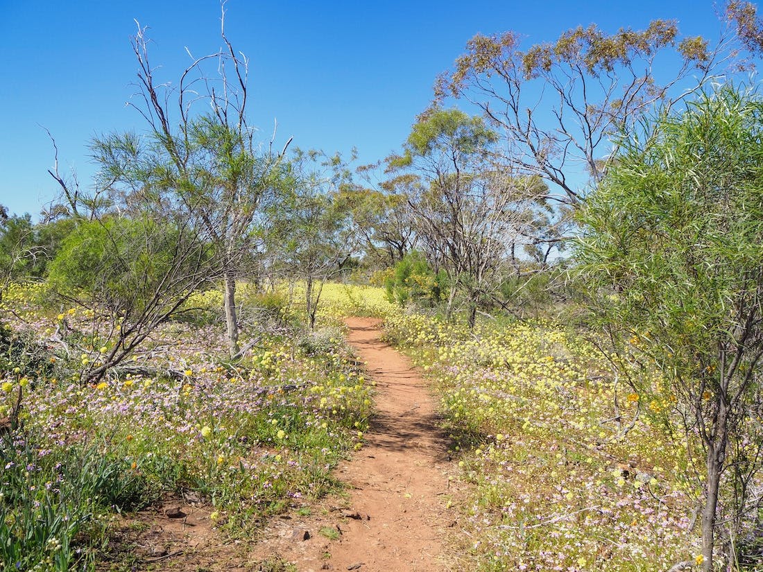
The Murchison region is best explored during the autumn to spring months, from April to October. It is especially beautiful in late winter and spring during wildflower season. Best not visited during summer, temperatures can be reeeeeeally hot and there is a risk of cyclones bringing flash-flooding with little warning.
GETTING AROUND
In good weather, the entire trip can be done in a 2WD, though some roads become a little more tricky after heavy rain – and the mining roads can be a bit tough on the old suspension on a small car. Still, nothing is impossible – we did it in a VW Golf – but if it’s hot out, you might want to make sure the AC is working and/or you have lots of water. We also broke down in Sandstone, but the super nice RAC mechanic in Mount Magnet sorted us out.
DON’T FORGET
Water! Spare fuel. GPS/offline maps downloaded before you go as a fair few places don’t have phone signal. Fly nets. Check your spare tyres and your oil and coolant before you leave too. Bring snacks, food and cash. If you’re camping, download Wikicamps, and if you’re hoping to stay in accommodation along the way, call up to check availability before you go or book in advance to avoid disappointment – especially during peak wildflower season.
Late winter/early spring is when all the wildflowers come out
HITTING THE ROAD
1 – Perth to Mount Magnet (~560 km)
With six hours of driving on the cards today – and a bit of an action-packed itinerary for the rest of the trip – you might want to get up early to get the show on the road. Let the dream of coffee and treats from Bindoon Bakehaus lead you through the city traffic as you escape from the hustle and bustle to the quiet rolling hills and the promise of outback adventures.
Following the Great Northern Highway north, stop in Dalwallinu for fuel – and perhaps to check out the flowers if you’re visiting in spring – before powering onto Paynes Find, where the funky roadhouse and tavern is the perfect place to stop for lunch.
Around 4.5 hours north of Perth, Paynes Find was once a flourishing early 20th-century gold-mining town, though these days it’s better known as the home of the only working gold battery left in WA. Visit the Paynes Find Gold Battery and Museum to see the old school gold-crushing ways in action along with plenty of other cool things like gemstones and artefacts.
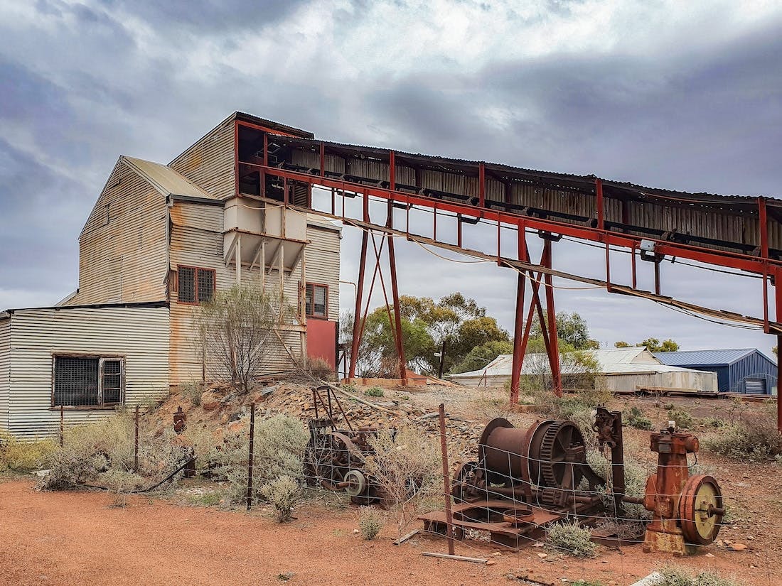
Paynes Find Gold Battery
From here, it’s another 130 km north to the hub of the Murchison, Mount Magnet. The longest surviving gold rush town in WA, the townsite is a unique outback blend of red dirt and murals, heritage buildings, friendly folks and mining dongas, but the area around ticks off the full ABC of the GeoRegion – epic landscapes, especially at the Amphitheatre and the Granites, awesome biodiversity with plenty of animals and wildflowers, and a rich cultural story, with rock art sites and sacred ochre mines.
Offering several accommodation options, it’s a great place to spend a night or two while you check out the local sights, including the Wirnda Barna Art Centre and the Mining and Pastoral Museum.
Hot Tip: If you’ve got time, head to the Amphitheatre or the Granites (see below) for sunset – and if you’re an early bird, maybe check out the other for sunrise!
Overnight: Mount Magnet
2 – Mount Magnet to Sandstone (~190 km)
Today’s journey is only around 3 hours, so you’ll have the morning free to explore Mount Magnet and do the 37 km self-drive Mount Magnet Tourist Trail. From here, we’ll be heading east to Sandstone and up to Meekatharra and then heading west from Cue, so if there’s anything else that interests you on the Great Northern Highway between Mount Magnet and Cue, now would be the time to check it out.
When you’re done exploring the local area – as far north as Lake Austin, if you wish – be sure to fuel up and check road conditions for the next step at the Visitors’ Centre, especially if you’re travelling in a 2WD, as the unsealed road between Sandstone and Meekatharra can be a little sketchy after rain.
If you’re running short on time and just want to tick off the highlights before heading east, then we recommend visiting the last abandoned miner’s cottage left near Boogardie Townsite (check with the Visitor’s Centre to see if it’s still accessible), and the Warramboo Hill Lookout – first put on the map by British explorer Robert Austin in 1854 – which offers sweeping vistas over the townsite and the huge gold mining pits carved into the otherwise flat horizons.
From here, it isn’t far to the Amphitheatre, where a rocky ridge rises from the earth like a natural stage. Sculpted by an ancient waterfall cascading over 3-billion-year-old Archaean rock, which is honeycombed with caverns and other geological marvels, it’s a great picnic spot, especially at sunset, when the golden light turns the red rock orange.
Or if time is really of the essence, The Granites are another geological and cultural treasure trove just north of town. A sacred site for the Badimia people for over 20,000 years, these epic breakaways feature secret rock art sites and are home to lots of local wildlife too.
The Granites near Mount Magnet
Once you’ve done your little loop north of Mount Magnet, head back to town and take the road east to Sandstone. A popular fossicking spot and the home of what was probably the most unusual brewery in all of WA, Sandstone is about 2.5 hours drive from Mount Magnet. It also sometimes comes up on Google Maps as the wrong place – so make sure you’ve got the town centre, which is to the east of Mount Magnet, not to the southeast.
A short way east, London Bridge is one of those semi-secret spots we probably shouldn’t be telling you about. Created by weathered basalt slowly eroding over the last 350 million years, this natural bridge spans a dusty courtyard and a valley filled with trees. Back in the 1900s, it was wide enough for daredevils to ride horses and carts across the top as others picnicked below. Now less than a metre wide, visitors are asked to refrain from climbing it to preserve it for as long as possible.
Around the corner, the old Black Range Brewery site might not look any different from the other rocks around, but you only have to step into the naturally cool cavern to understand why the original brewers – who were Irish, of course – chose this spot for their beer-making operations in 1907.
Using the natural formation of the breakaway to form a multi-level brewery was pretty ingenious, with the beer brewed up top and the ‘cellar’ keeping the beer refreshingly cold. Unfortunately, the arrival of the railway to Sandstone in 1910 brought an endless supply of cheap beer and put an end to the brewer’s dreams. Still, it was good while it lasted.
Hot Tip: Go to London Bridge at night for epic stargazing
Overnight: Sandstone
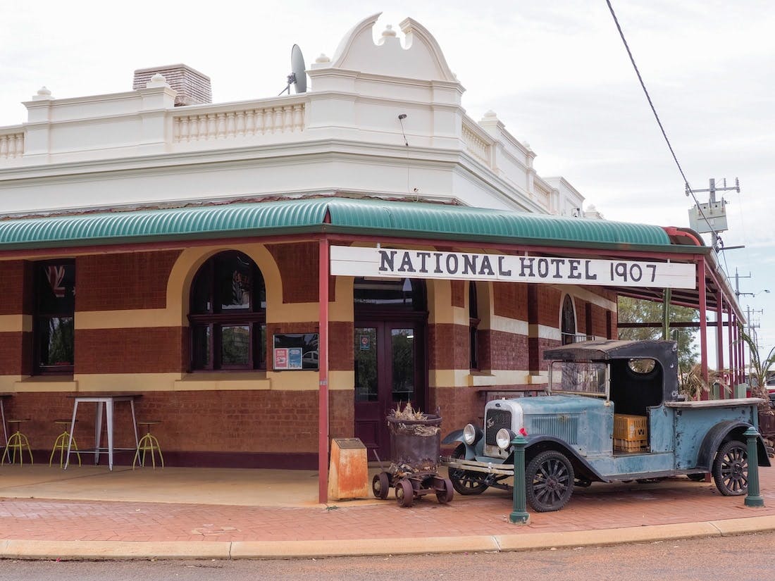
Sandstone’s National Hotel is a world away from its first brewery
3 – Sandstone to Meekatharra (~200 km)
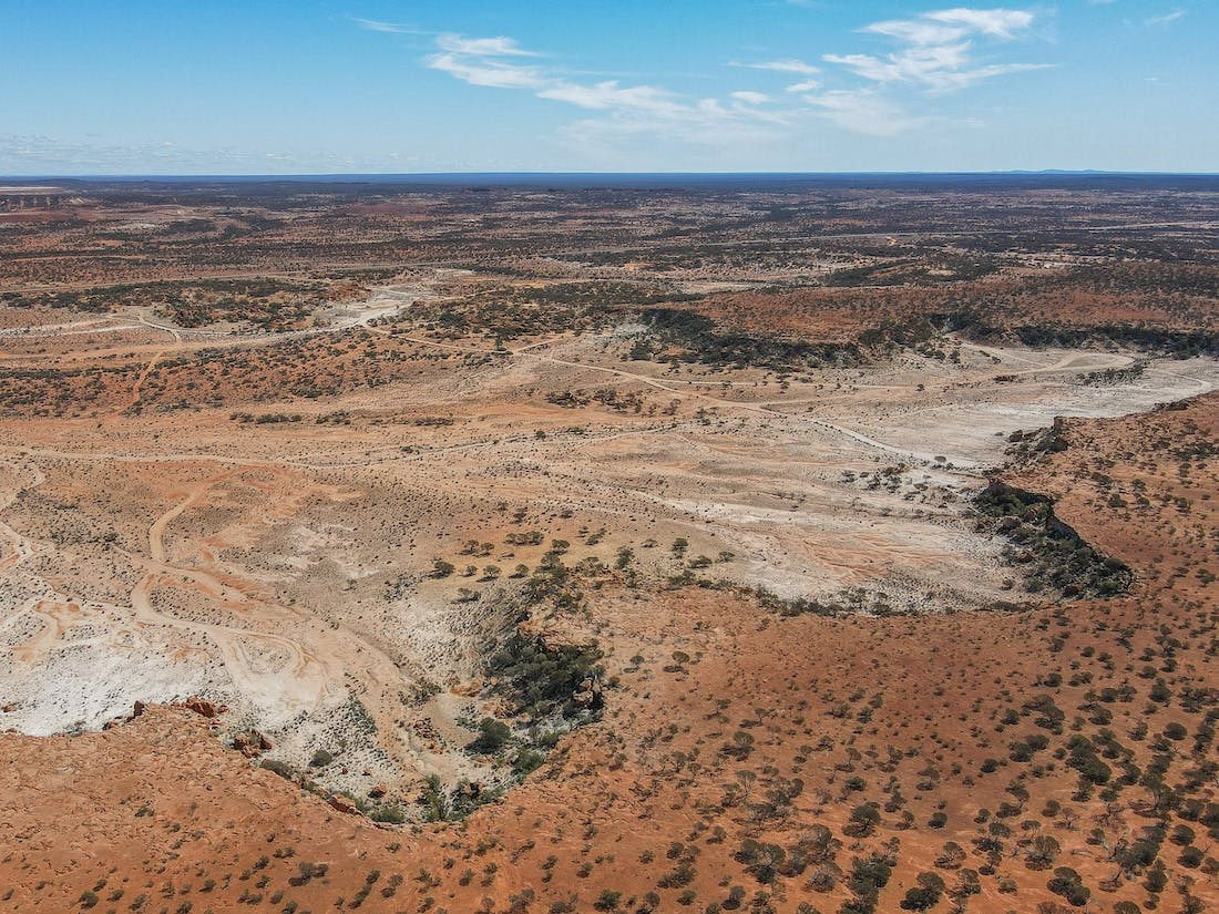
Today’s drive takes you up northwest from Sandstone to Meekatharra via an unsealed road. The true Outback experience, the road traverses past ancient landscapes shaped by ancient meteorite craters over 2.3 billion years ago and huge sacred rocks and desert oases, as well as deserted townships and mines left from the heydays of the Wild West’s gold rush.
Your first stop is Barlangi Rock, a huge rock that was forced over 30m into the air when the aforementioned meteorite smashed into the earth billions of years ago. One of 27 confirmed meteorite impact craters in Australia – and one of two you’ll visit on this trip – Barlangi might not look like much from the surface, but it’s still a geologist’s dream and a good box to tick on the road between Sandstone and Meekatharra.
No need to worry about traffic jams out here!
Another giant rock, Mount Yagahong is one of those places you can see towering over the horizon in the distance. 40 km southeast of Meekatharra, this is a 150m-high rocky outcrop said to be shaped like a lying down emu. Both the rock and the fertile soils that surround it are sacred to the Yugunga-Nya people, with over 70 species of native plants and bush tucker growing in this desert oasis. Please respect the custodians of this land and do not climb the rock.
If you time it right, you’ll arrive in Meekatharra around lunchtime and be able to spend the afternoon sightseeing. Named after the Yamatji word for “place of little water”, Meekatharra – or Meeka – was once known as “the end of the earth”. Another former gold rush town, these days it’s a tourist hotspot, its position on the Great Northern Highway inland route between Perth and Port Hedland bringing plenty of road trippers through.
A good spot for an overnight – and a shower – after your long drive through the outback, there’s plenty to explore here, including the heritage buildings in the town centre, the Meekatharra Museum, the views from Meeka Lookout, the Meeka Drive Trail and, our favourite, the outdoor Picture Garden, which has been showing flicks since the ‘70s.
North of town, Peace Gorge is a gorge-ous – sorry, not sorry – spot for sunset. Once called the Devil’s Playground, Peace Gorge earned its new moniker after being chosen to host a picnic that celebrated the returning soldiers at the end of WW1.
Whatever the name, the place has been loved for millennia, with colourful boulders and rock formations that are fun to explore. Home to lots of local wildlife, the nature reserve is also super beautiful, especially in late winter and early spring when the wildflowers are out.
Hot Tip: Take a picnic to Peace Gorge at sunset
Overnight: Meekatharra
4 – Meekatharra to Yalgoo (~360 km)
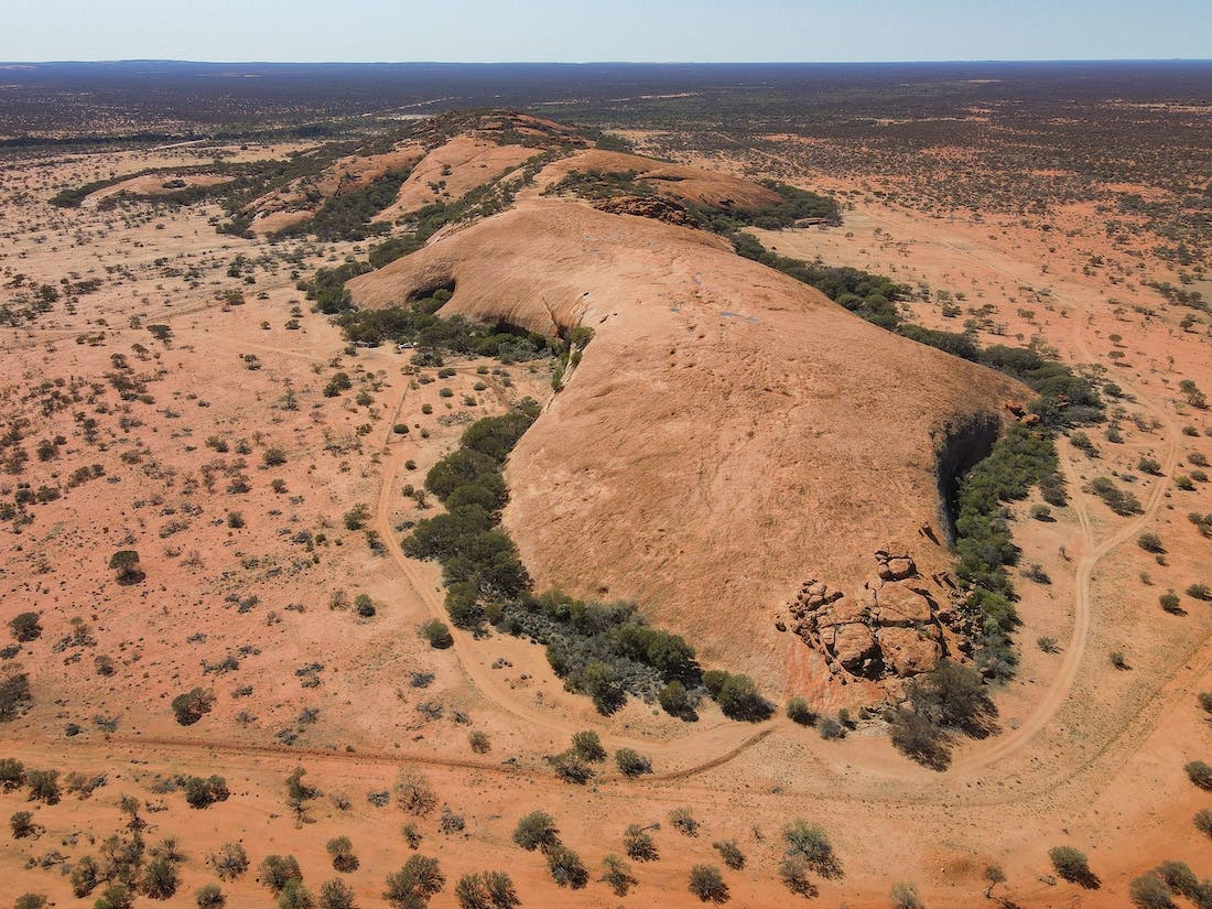
Today is another big day, but it can also be a ‘choose your own adventure’ kind of one, where you can rush through or take it slow, depending on what you’re interested in. There are ghost towns, gold mines, abandoned hospitals and (almost) definitely haunted buildings, Western Australia’s largest outdoor Aboriginal art gallery at a billions-year-old monolith second only to Uluru in its size and meteorite craters. And, the beautiful Queen of the Murchison, where you’ll want to spend at least a few hours and have a meal.
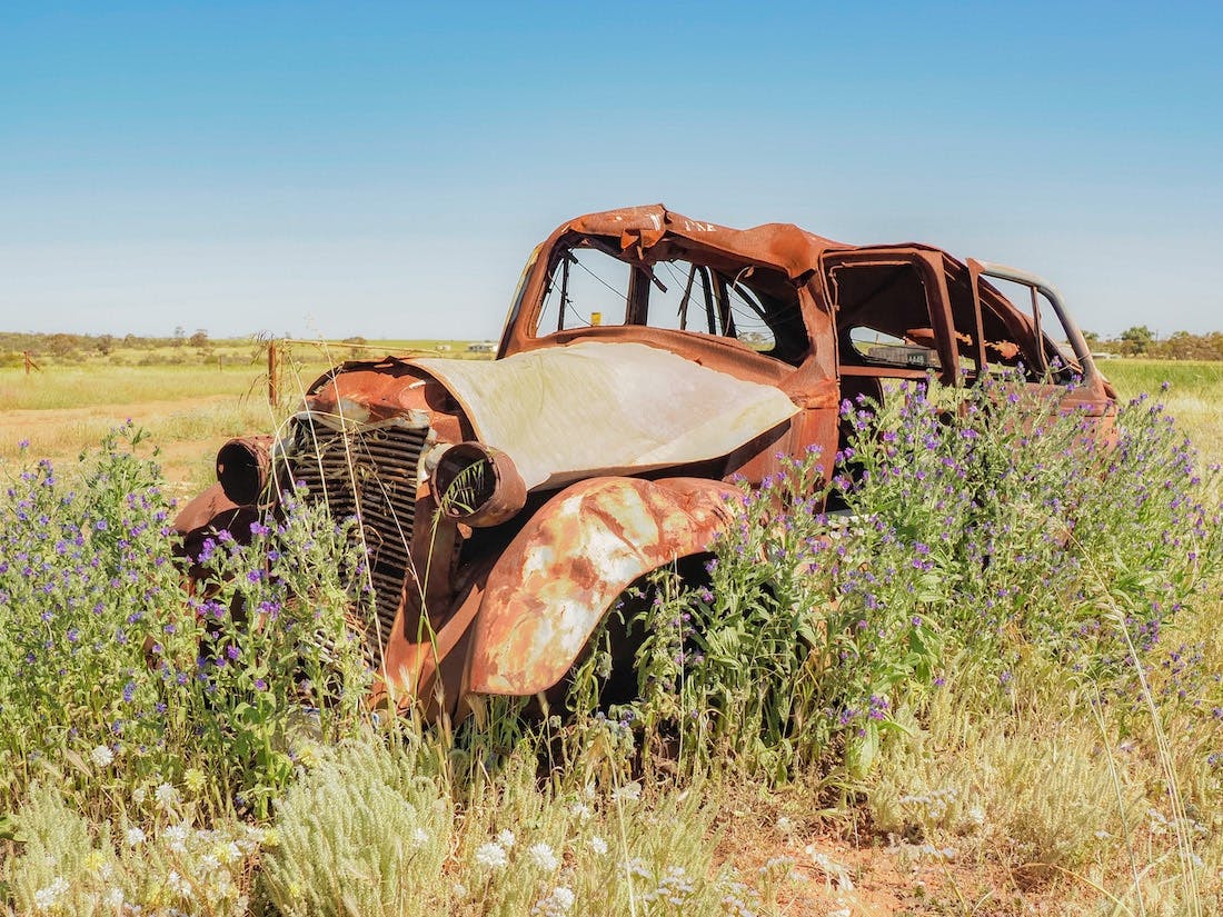
If you’re playing Day 4 Bingo with us and ticking off all the stops, then your first port of call is Nannine Ghost Town. The Murchison is home to more than a few ghost towns, but the most famous are probably Nannine, which is just 25 minutes south of Meekatharra, and Peak Hill, which is 2.5 hours north. Given that a 400 km detour is a little excessive, Nannine might have to do.
Not quite as exciting as the ghost towns of the Goldfields or Cossacks in the Pilbara, there’s little more here than rusting cars and an old railway strip these days, but with no detours required, it’s still a good place to stop and stretch your legs on the way to Cue.
The Queen of the Murchison, Cue is a beautiful little town on the Great Northern Highway between Mount Magnet and Meekatharra. The streets are filled with old heritage buildings – like the Old Gentleman’s Club (now the Shire Council), the Cue Hotel and Bell’s Emporium – but it’s the weirdest and the ones falling down that have captivated our imagination. First on our list, the somewhat spooky Masonic Lodge – the largest corrugated-iron building in the southern hemisphere – and second, the ruins of the Old Cue Hospital, which are pretty creepy but still kind of cool.
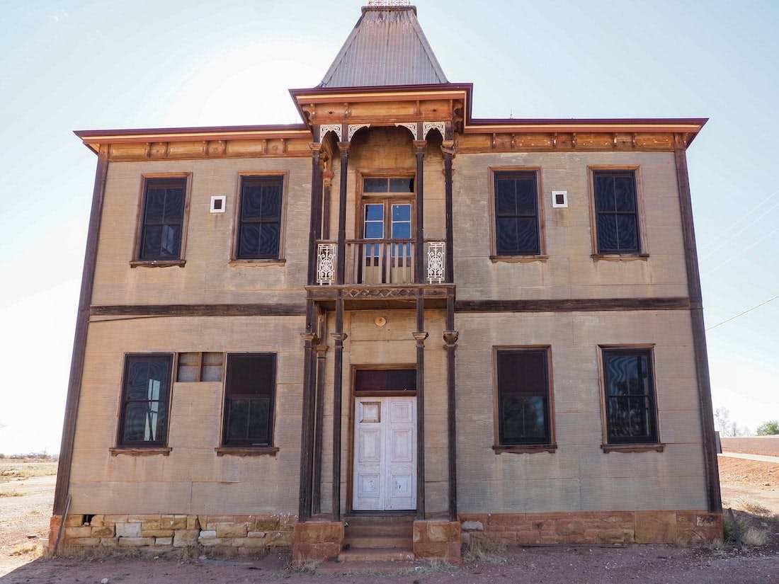
The Masonic Lodge, Cue
From here, it’s time to set the GPS to adventure town as you check out one of our favourite places in the Murchison, Big Bell Ghost Town. Arguably the most Australian ghost town in Australia, with a huge abandoned pub to explore. Once the life of the town – and the party – the Big Bell Hotel rang its bell for final orders in 1955 and the rest of the town followed suit swiftly afterwards. The rest of the town deserves a quick drive-through, with old cars and a couple of tumbledown shacks, but the pub is the highlight here, for sure.
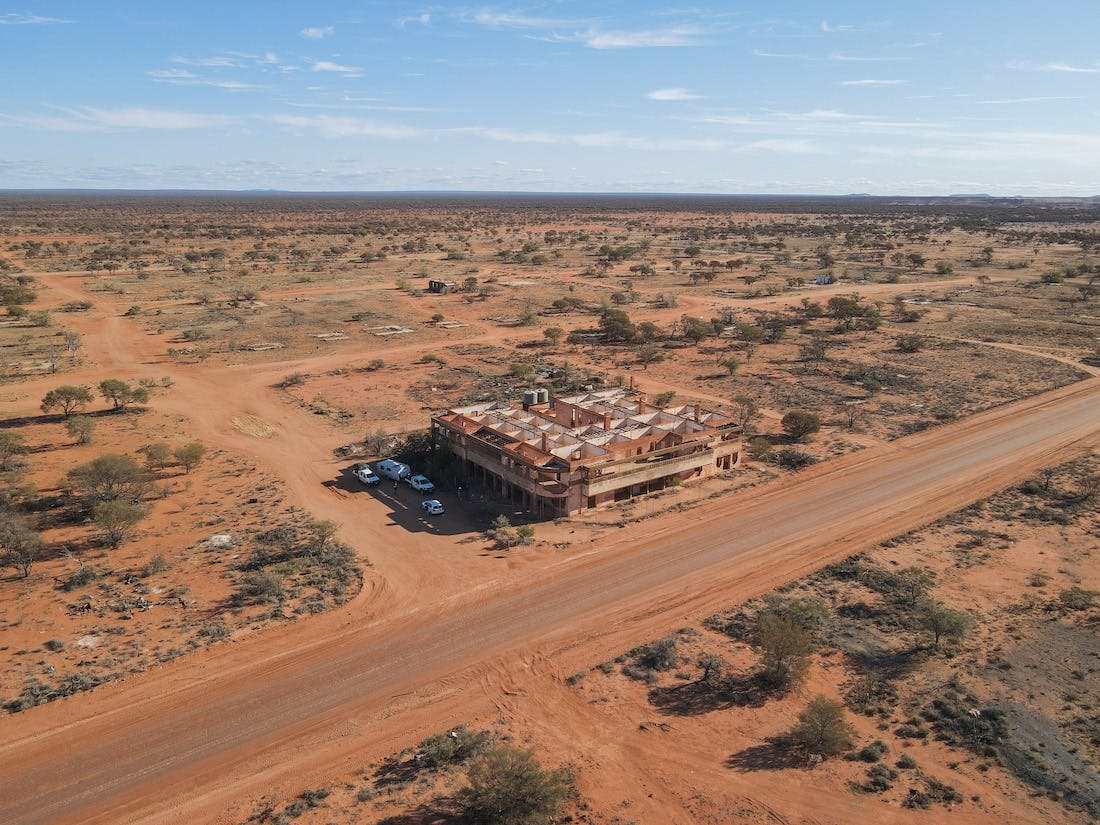
Big Bell Ghost Town
Next up is another not-to-be-missed place, Walga Rock. While it can be sometimes hard to find from the road – you’d feel somewhere as epic as this should be better signposted – that isn’t a sign of what’s coming. This 2.6 billion-year-old monolith – Australia’s second-biggest after Uluru – has been providing shelter to the Wajarri people for over 10,000 years and is home to the largest outdoor Aboriginal art gallery in Western Australia.
Featuring nearly a thousand Wajarri paintings depicting local animals, figures, Dreamtime stories and handprints, the rock has become especially famous for one painting in particular – a sailing ship in white ochre; its origins a mystery that has intrigued visitors to the rock for over a century.
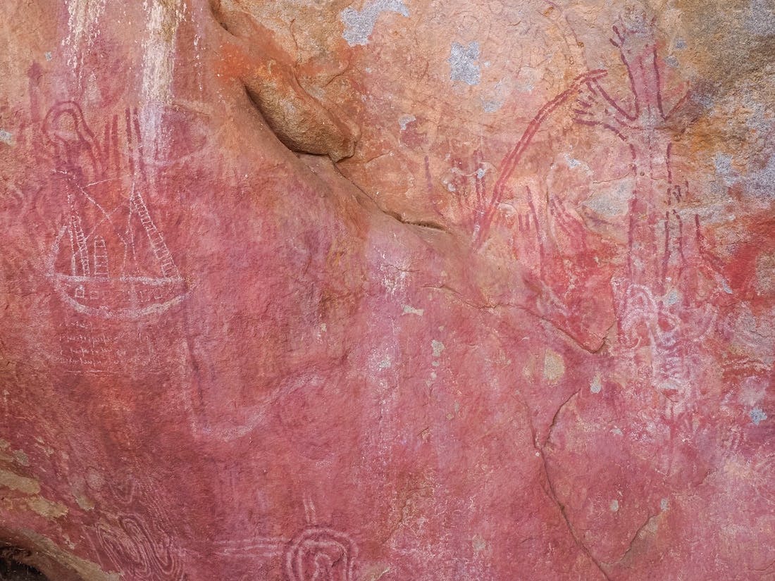
The origins of Walga Rock’s mysterious ship have puzzled visitors for over a century
From here, the hardiest adventurers might want to venture out to the second meteorite crater on our itinerary, Dalgaranga Crater, while others might prefer to give it a miss as it is a little underwhelming. Super tiny compared to some of the others – hello, Wolfe Creek! – Australia’s smallest and potentially youngest impact crater, Dalgaranga was formed by a super rare mesosiderite meteorite.
Yet while the site is probably not the most interesting to any other than the most passionate geologists, the story behind its discovery is – with a catalogue of errors including forgetful uncles, moving offices, misspelt names, untimely deaths and a serendipitous encounter on a ship meaning it took four decades for it to be officially recognised.
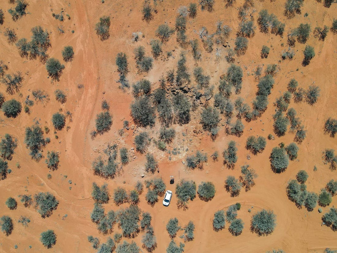
Dalgaranga Crater
Back on the main (unsealed) main road between Walga Rock and Yalgoo – Dalgaranga is just a short detour – Chinaman Rock is a pretty stop-off point with a great view and a couple of natural gnamma holes where wildlife come to feed. It – like much of the region – is especially beautiful in spring when the wildflowers are aplenty.
When the bitumen gets back in sight, you’ll know you’ve almost reached your final destination for the day, Yalgoo. A tiny ex-gold rush town on the Geraldton-Mount Magnet road, Yalgoo – named after the local Aboriginal word for blood, probably due to the presence of the Yalguru bush and its blood-red sap – has little more these days than a few interesting buildings. The most famous is probably the Dominican Chapel of St Hyacinth, designed in 1920 by the same skilled priest whose passion for architecture led him to create marvelled buildings across WA’s Midwest from Geraldton and Carnarvon to Mullewa, Monsignor John Hawes.
Other interesting buildings are the Yalgoo Railway Station, which was built in 1896 and has been out of action since the railway closed in 1978, and the Court House Museum, which was originally the Day Dawn Court House before being moved to Yalgoo in 1921 after theirs lost their roof in a storm.
Ten clicks south of town, Jokers Tunnel is also a popular tourist site. Tunnelled out by hand in 1896 by the Joker Mining Syndicate, who probably hoped that it would lead to riches beyond their wildest imaginations, the 100m Jokers Tunnel ended up being more of a trick than a treat – especially on the investors who had funded the entire operation (and some believe it to have been a scam all along!) Now, most of the local gold mines are closed, it’s become a bit of a tourist attraction, with visitors able to walk – or at best, crouch – through the length of the tunnel.
Yalgoo has also become especially popular during wildflower season with visitors coming from all over the world to see the famous wreath flowers.
Hot Tip: Just north of Cue, Melangata Station Stay is a super cool spot to spend a night or two. The only private residential building designed by Monsignor John Hawes, the lovingly restored historic homestead is a sight to behold. They have luxury stays with home-cooked dinners in the homestead as well as family-friendly cottage accommodation, a glamping bell tent and a big campground and offer tours, morning tea, cooking classes and more.
Overnight: Yalgoo
Subscribe to our free newsletter!
5 – Yalgoo to Perth (~500 km)
From Yalgoo, you’ll head south to Perth. The quickest way back is via Morawa, Carnamah, Coorow and Moora, which are popular spots to visit during Wildflower season. Alternatively, if you’re missing the ocean and just want to jump in and wash off all the red dust, you can follow the road to Geraldton and take the highway south past Dongara, Green Head and Jurien Bay, which will take around seven hours without stops.
Hot Tip: If you are visiting during Wildflower season – and aren’t yet all flowered out – you can also go via Coalseam Conservation Park, adding about an hour to the (already quite long) journey, this is one of the most popular places in WA to see the carpets of everlastings.
Coalseam Conservation Park
All photos belong to Cassie Wilkins.