The Golden Pipeline Heritage Trail: Everything you need to know
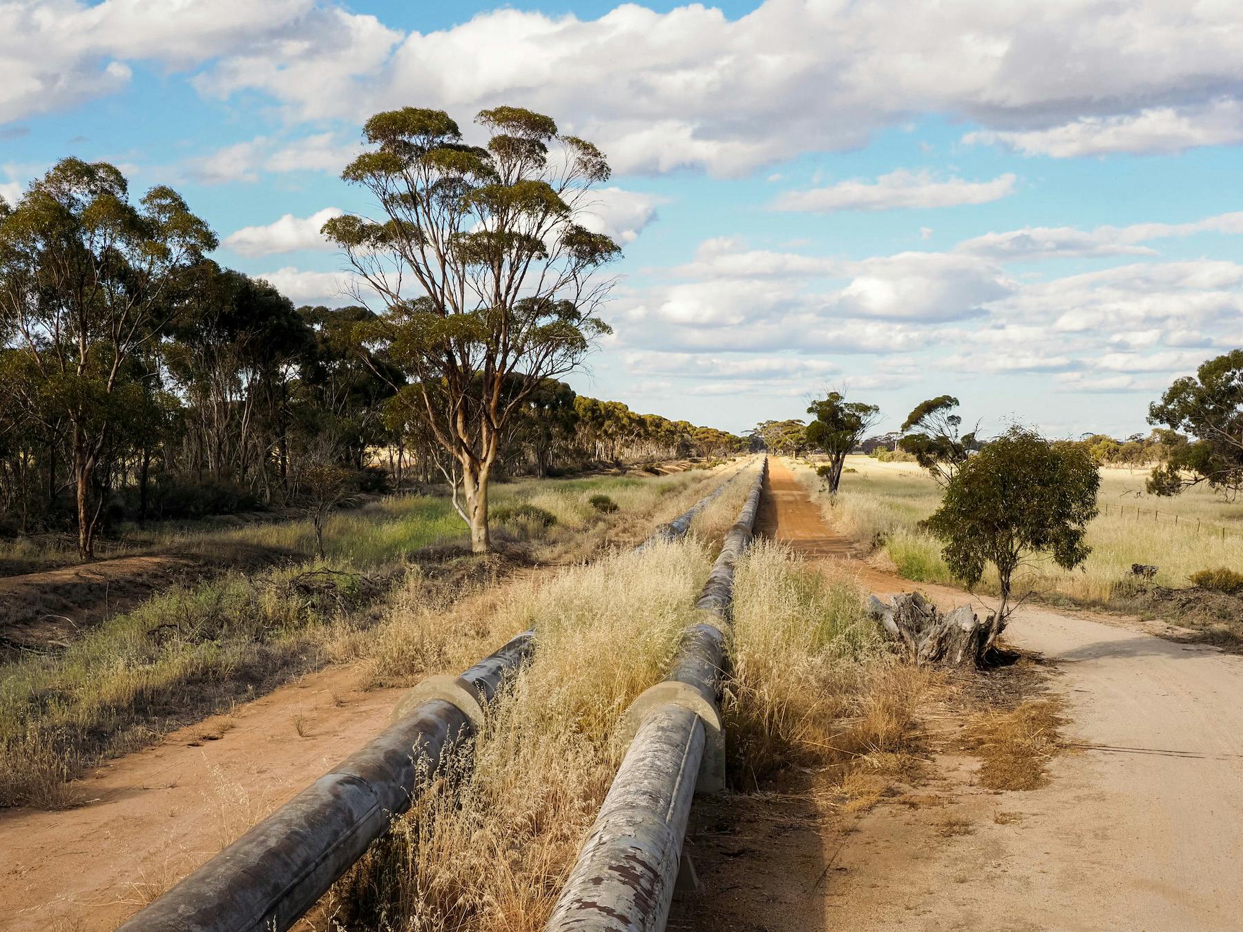
An epic road trip from the lush hills of the city, through the Wheatbelt and out to the red sands of the outback, the Golden Pipeline Heritage Trail is a journey of historical discovery, quaint rural towns, quirky pubs, colourful silo art, freaky cemeteries and long-abandoned ghost towns.
Words and photos by Cassie Wilkins.
What is it?
A “hair-brained” 19th-century engineering marvel so ahead of its time no one thought it would work, the Golden Pipeline is a network of giant steel pipes that carry water all the way from the forested shores of Mundaring Weir to Kalgoorlie-Boulder, 560 km to the east.
As valuable as the gold it’s named after, this “scheme of madness” (as it was once referred to) is still the lifeblood of the Goldfields, responsible for riches beyond people’s wildest imaginations and — since its expansion into the Wheatbelt — well-hydrated towns across the state.
Running alongside the pipeline, the self-drive Golden Pipeline Heritage Trail is one of WA’s best off-the-beaten-track road trips, with 25 stops along the way teaching you about the stories of the pipeline and the people, the history of the area and the tales of the world’s last great gold rush, while exploring the varied beauty of one of the oldest landscapes in Australia, the gigantic Yilgarn craton.
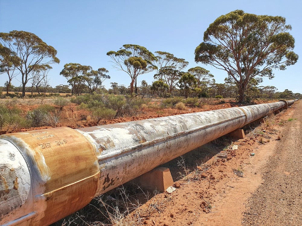
Workers would carve their initials into the pipeline when they did maintenance work. At one point the entire length of the pipeline was monitored by a relay crew on bicycles who would cycle up and down checking for leaks
A resource as precious as gold
In a story echoed around the world, it didn’t take long from the second the British first stepped foot on Western Australia to them going out bush searching for gold and riches. And yet, while they soon stumbled upon a soon-to-be literal goldmine, many learned the hard way that freshwater is far more valuable than shiny metal.
Although the Wongatha people, who had inhabited this ancient land for tens of thousands of years, shared their precious secrets for survival with these new arrivals (something they would later grow to regret), there wasn’t enough to quench the thirst of the first wave of prospectors, let alone the camel caravans and steam trains that would soon arrive.
Over the years that followed, people tried everything to get water to the Goldfields — desalinating salty bore water, trapping rainwater, using horses, carts, camels and trains to transport it across the dusty plains, but there was never enough.
And so, in a last-ditch attempt to supply water to the growing towns, the state’s chief engineer CY O’Connor — famous for spearheading both Fremantle Port and the railway — proposed an epic project, a steam-powered pipeline that would propel water almost 600 km from Perth to Kal.
While many said it was impossible, CY O’Connor threw everything into the project, even his own life. And although he didn’t live to see it turned on for the first time in 1903, almost 120 years later, the Golden Pipeline is not only a lifeline for many — it’s also the living legacy of one of the world’s greatest engineers and a monument to human’s marvellous ability to overcome all obstacles.
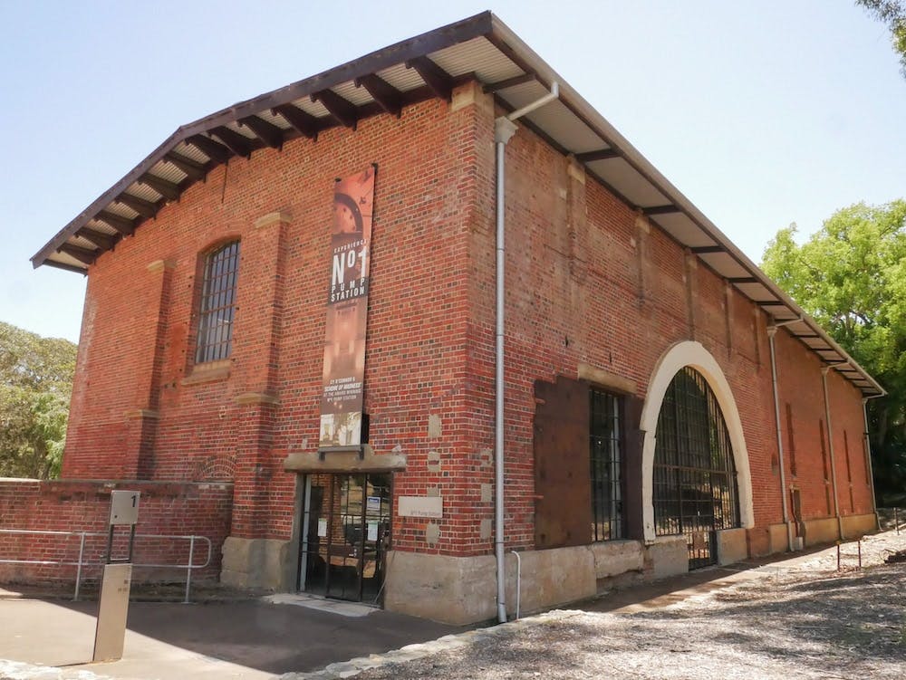
No.1 Pumping Station in Mundaring was once where the operation all began. Located at the foot of Mundaring Weir, it has now been converted into a museum about the Golden Pipeline.
Where is it?
The Golden Pipeline Heritage Trail is a self-drive one-way road trip itinerary that runs alongside the Golden Pipeline. It starts in the Perth Hills — approximately 45 minutes east of the CBD — and ends in Kalgoorlie-Boulder.
Unlike the water, which takes between 7 and 14 days to arrive at its final destination, the drive can be done in a day, but with lots of interesting stops en-route, you probably want to take it a little slower and break it up with a stop halfway.
What to do?
With heaps of things to see, this is a bit of a choose your own adventure itinerary. Whatever your interests, you’ll find plenty of interesting sights along the way, from Meckering’s earthquake-damaged and camera-shaped buildings to the abandoned refractory at Clackline, salt lakes best known for waterskiing, a mini wave rock and forested groves next to old reservoirs filled with wildflowers in spring. But we don’t want to spill all the secrets — so here’s a rundown of some highlights.
Mundaring Weir
The first stop on the Golden Pipeline Heritage Trail is at Mundaring Weir in the Perth Hills. Holding the equivalent of 7,700 Olympic-sized pools, this huge reservoir holds the water that gives life to the Goldfields. The place where the dream began, the dam is also home to Pumping Station No.1, an impressively imposing red-brick affair with a giant chimney. Now a museum, swing by to learn more about the pipeline and its history before heading to Mundaring Hotel for a quick tipple. Built to provide shelter, sustenance and cold beers to the hard workers, it now offers the same to tourists and daytrippers.
Northam
Following the pipeline through the countryside to Northam, you’ll see the first of two PUBLIC Silo Art trail murals on the trail. Painted on huge CBH silo bins in 2015, this giant outdoor art exhibition marked the beginning of a colourful wave that would go on to brighten up grey silos, factories and rural communities across Australia.
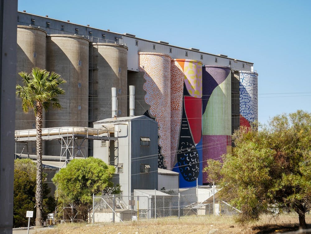
The PUBLIC Silo Art project began in Northam in 2015, before making its way across the country, rejuvenating rural towns in a blaze of colour and glory.
Cunderdin
Passing into classic Wheatbelt farming territory, the trail continues on through Meckering and onto Cunderdin. Now home to the amazing Cunderdin Museum, No.3 Pump Station is one of the best-preserved pump stations where you can see the old architecture up close and learn more about the pipeline, life through the ages in the Wheatbelt and heaps of other stuff — there’s even a Tigermoth aircraft. Opposite the old Victorian-style pump station, Cunderdin’s funky Ettamogah Pub is a great place to refuel and stop for an overnight break.
Merredin
From there, it’s on to Merredin via Tammin and Kellerberrin, with optional side missions to Baandee Lakes and Jureen Mission. Built on the site of a traditional Aboriginal camping site and meeting place, Jureen Mission was established in 1933 as a governmental way of controlling displaced Indigenous people who had been forced from their homes and traditional ways of life by the changing agricultural landscapes in the Wheatbelt.
The halfway point on the Golden Pipeline Heritage Trail, Merredin is a great place to break up the journey. There’s also plenty to see here, including Merredin Peak, more PUBLIC Silo Art, No. 4 Pump Station, the Merredin Military Museum, Cummins Theatre and Totadgin Rock, 11km to the south. Fun fact, the clock on the town hall was also made by the same crew who made Big Ben in London, so that’s a nice little claim to fame.
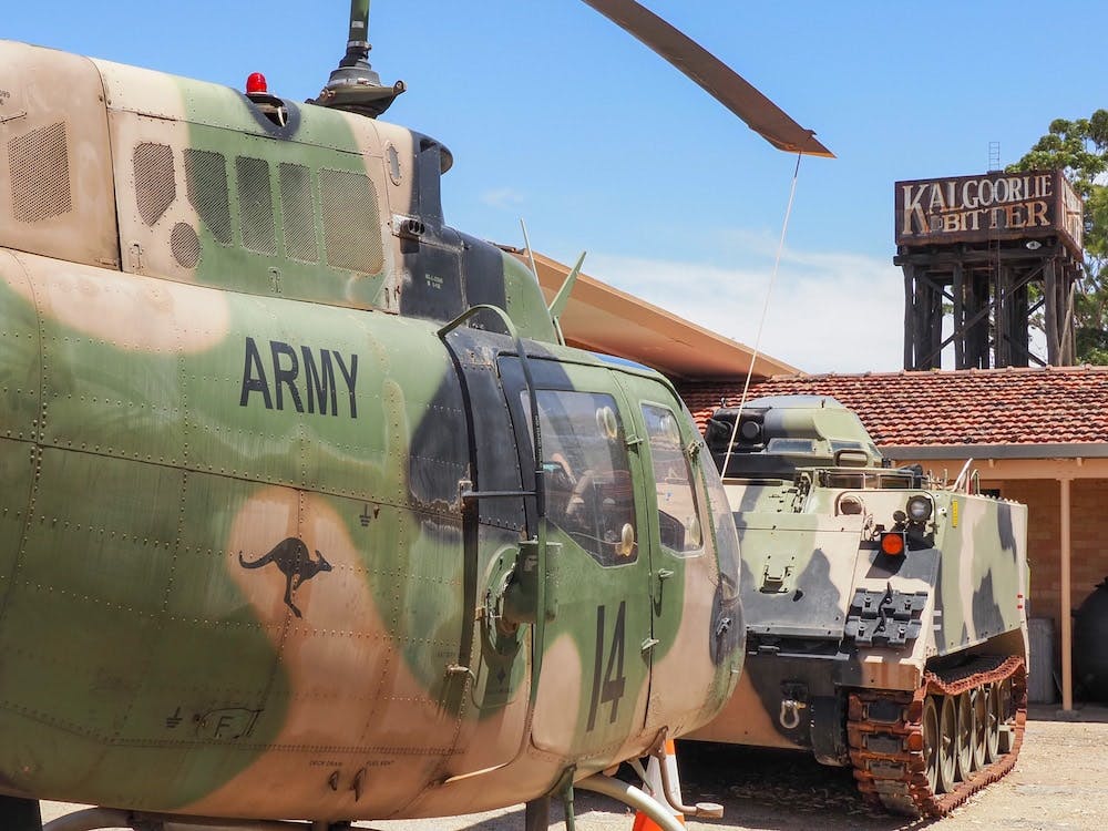
Located right next to the highway, Merredin Military Museum is a fascinating place that tells the story of how this unlikely country town became an important place in WA’s WWII defence strategy.
No.1 Rabbit Proof Fence
As you continue east along the Old Goldfields Road you’ll cross the No.1 Rabbit Proof Fence at Burracobbin. Also known as the State Vermin Fence and the Emu Fence after the events of the Emu War in Mukinbudin, not far to the north, this is a pretty interesting stop for a history lesson.
Moorine Rock
While No.5 Pump Station is closed for the time being, if you feel like an extra little adventure you can join the unsealed sandy access road at Yellerberin and drive alongside the pipeline to Bodallin before heading to the Art Deco style Moorine Rock Hotel for a well-deserved cold beer on the way to Southern Cross.
Southern Cross
Named for the stellar constellation which led a handful of lost and thirsty prospectors to their discoveries of gold in 1888, Southern Cross was once the centre of the gold rush. Now, though, it’s a sleepy town with a few cool old buildings like the heritage-listed Palace Hotel, the old courthouse and the Yilgarn History Museum.
Karalee Rocks & Boondi Rock
Southern Cross also marks the point where the Wheatbelt meets the Goldfields, and the land becomes increasingly dry and dusty — unless it’s spring, in which case the wildflowers are pretty spectacular. Still, there are some cool nature spots on this section of the pipeline, like Karalee Rocks — where there’s a not-quite-natural but still impressive old metal and wood aqueduct built to funnel water from the rocks to a giant dam hand-hewn from granite boulders — and Boondi Rock in Goldfields Woodlands National Park, which is a great spot for camping.
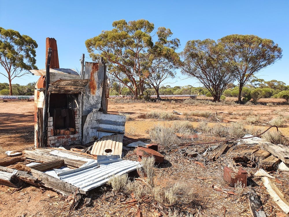
The Golden Pipeline runs alongside the ruins of Woolgangie ghost town, where many people lost their lives to typhoid. Eventually, they would send water in train carriages, but it still wasn’t enough.
Woolgangie
From here, it isn’t far to the spooky ghost town of Woolgangie. Looking around the rusty ruins, it’s hard to believe that this was once a town — let alone one that once housed thousands of men and horses who were here for months waiting for enough rain to fill up their water reserves so they could continue onto Coolgardie, which is now just an easy 45-minute drive away. There were mass outbreaks of typhoid and big tent hospitals with nurses who came all the way from over east. It’s a cool but creepy place.
Pump Station No.8
While Pump Station No.1 and No.3 are pretty impressive places to visit, Pump Station No.8 at Dedari — when it’s open — is even more so. In fact, it’s remained pretty much unchanged since the pipeline converted to electric and the old boilers were turned off for the final time in 1970, making it an accidental time capsule of years gone by.
The final Pumping Station on the trail, it was originally designed to pump water along the last little bit of pipeline to Coolgardie, but by the time construction began in the early 1900s, Kalgoorlie was the new Golden kid (town) and so they had to extend it on a little bit further.
Coolgardie
Once the third-largest town in WA (after Perth and Freo), Coolgardie is now best known for its huge streets — wide enough to turn around a colourful 45 camel caravan (yup, that’s 45 camels in a row!) — striking heritage architecture and one remaining pub, as well as the cemetery on the outskirts of town.
If you do have the chance, visit the Coolgardie cemetery and head to the Afghan cemetery in the very back corner, where the gravestones tell stories of cameleers, coldblooded murders and the joy of being reunited with their ancestors a century after they died alone in a foreign land. It’s a fascinating place.
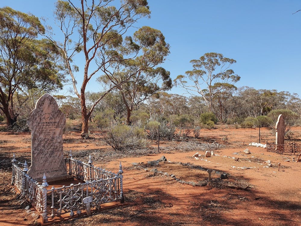
Tucked away on the edges of the Coolgardie cemetery, the Afghan graves are a fascinating tale of murder, loss and familial rediscovery.
Kalgoorlie
From Coolgardie, it’s a final easy cruise into Kalgoorlie-Boulder, where you’ve hopefully arrived in time to catch the sunset from the top of Mount Charlotte, the final stop for the Golden Pipeline and its precious cargo.
Looking over the town below, you can all but imagine how desolate and inhospitable this place would have been back in 1893 when Paddy Hannan found the first glimpse of gold in the dirt — sparking both the gold rush that put Australia on the map and an idea so wonderful and revolutionary that it would go down in history as one of the world’s greatest engineering successes.
From up here, you can see the streets and houses that have been built here on the back of the mines and the pipeline, the ornate hotels that have catered to prospectors, mine workers and tourists alike for over a century and probably will for a century more, and the mines themselves. And yet, without CY O’Connor and his Golden Pipeline, it’s quite probable that none of this would have been possible.
It’s an interesting point for reflection on both man’s desire to control nature and their ability to do so quite so impressively — before heading down the hill into town for a much-deserved beer.
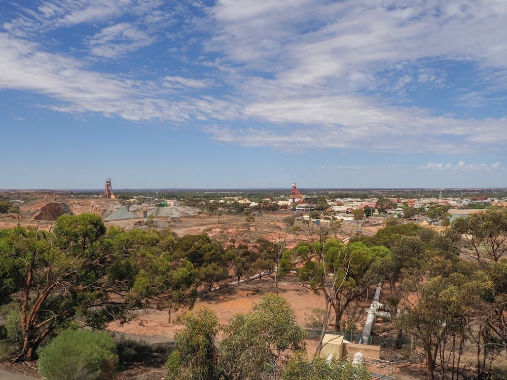
From atop Mount Charlotte, you can see the Golden Pipeline on its final home stretch, the goldmines that started off the ambitious scheme and the town that has grown around it.
What not to do:
Take photos, not things. A lot of the historical sites and along the pipeline itself have old rusty machinery and things lying around — also, a good reason to wear closed shoes rather than thongs — but do the right thing and leave it where it lies to tell the stories of the past. On that note, do take your rubbish with you though, especially if you’re camping. No one needs to see that.
Where to stay?
Whether you’re tenting or swagging, (cara)van-lifing or living it up in luxury, there are plenty of places to break up the journey. While Merredin is the natural choice for a halfway stop, an extra night in Northam means you can squeeze in a sunrise hot air balloon trip soaring above the rolling patchwork of hills and valleys below.
History lovers will also be able to spend a night in many an old hotel and hear some interesting tales from the locals in the quirky pubs along the way, while nature lovers have a few campsites to choose from where they can pitch their tents next to ancient rocks and even old townsites.
And if time is of the essence, you can just squeeze in a few highlights on the way to Coolgardie or Kalgoorlie-Boulder where there are plenty of historic hotels to stay in.
What next?
While you can easily do the Golden Pipeline Heritage Trail over a long weekend, if time is really of the essence, you could hire a car in Perth, drive the trail to Kalgoorlie and then hop on a train or plane back to the capital. Alternatively, you can cruise back along the Great Eastern Highway in about 5.5 hours.
However, if time allows, you can make an epic road trip loop by adding on the Golden Quest Discovery Trail through the Goldfields and up to Gwalia and then coming back via Paynes Find, going to Norseman and following the road to Hyden and Wave Rock or even veering northwest from Southern Cross and tracing the road past Mukinbudin and Wyalkatchem back to Perth.
Anything else?
While you can visit the Golden Pipeline Heritage Trail whatever the weather, it’s nice to visit when the weather is cooler between May and September (and the flies are fewer!). The trail is also especially picturesque when everything is green and the wildflowers are all in bloom in the spring.
While most of the trail including a handful of unsealed roads to attractions like Karalee Rocks and Woolgardie are 2WD accessible, they might not be after heavy rain, so take it easy.
Phone signal can be a little spotty along the Golden Pipeline Heritage Trail, so make sure you download your maps offline and let people know where you’re going and when they should expect you to be back.
It’s also a good idea to stock up on water and necessities before you leave, but if you stop by the towns along the way maybe grab a snack or some supplies from the IGA or the shops or grab a drink at the pub. It makes a big difference to these communities and gives a great little insight into everyday life out here.
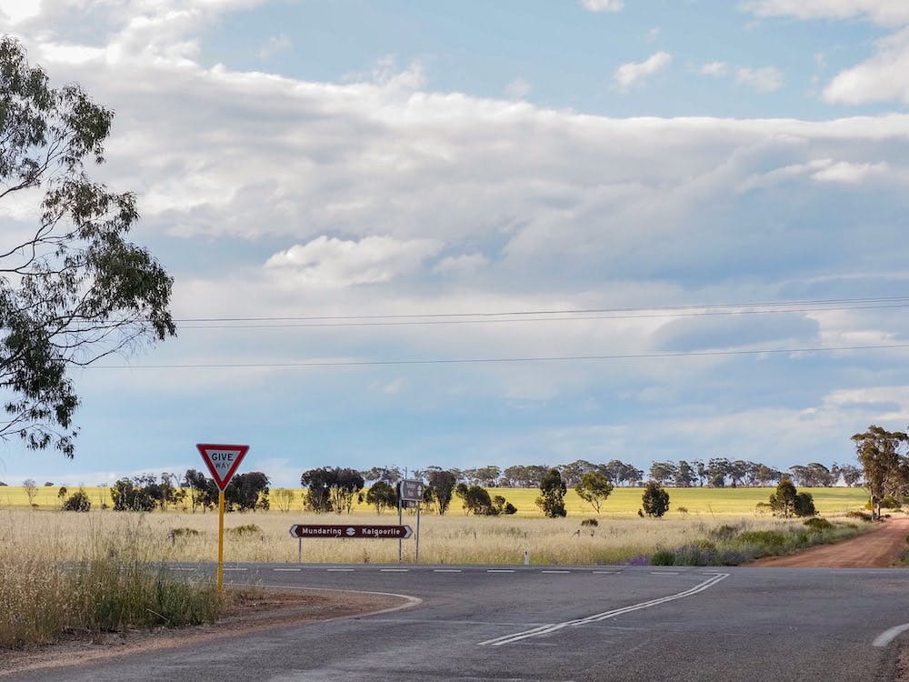
The Golden Pipeline Heritage Trail is signposted between Mundaring and Kalgoorlie
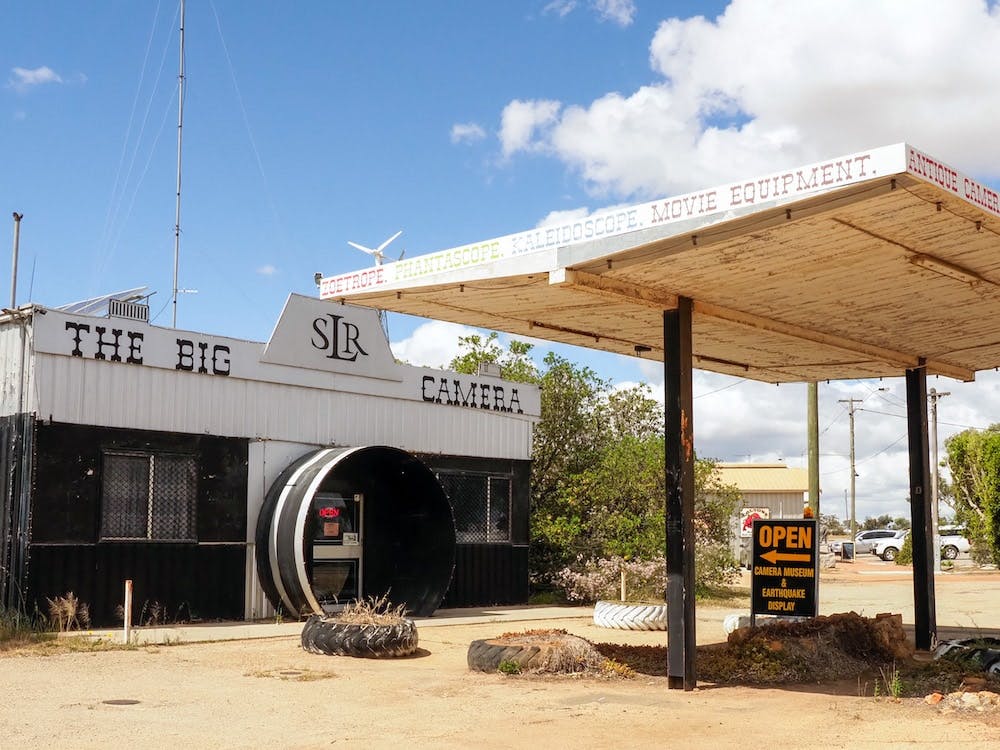
The Camera Museum in Meckering has an interactive earthquake exhibit and is well worth a visit when you swing through
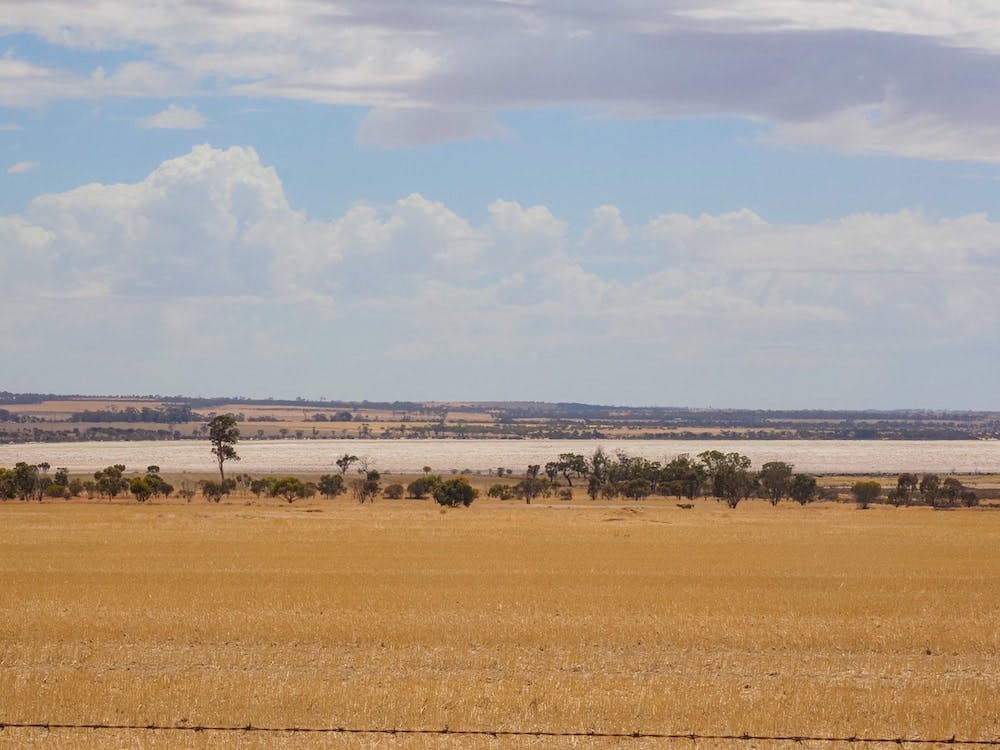
Waterskiing used to be a popular winter activity on Bandee Lakes
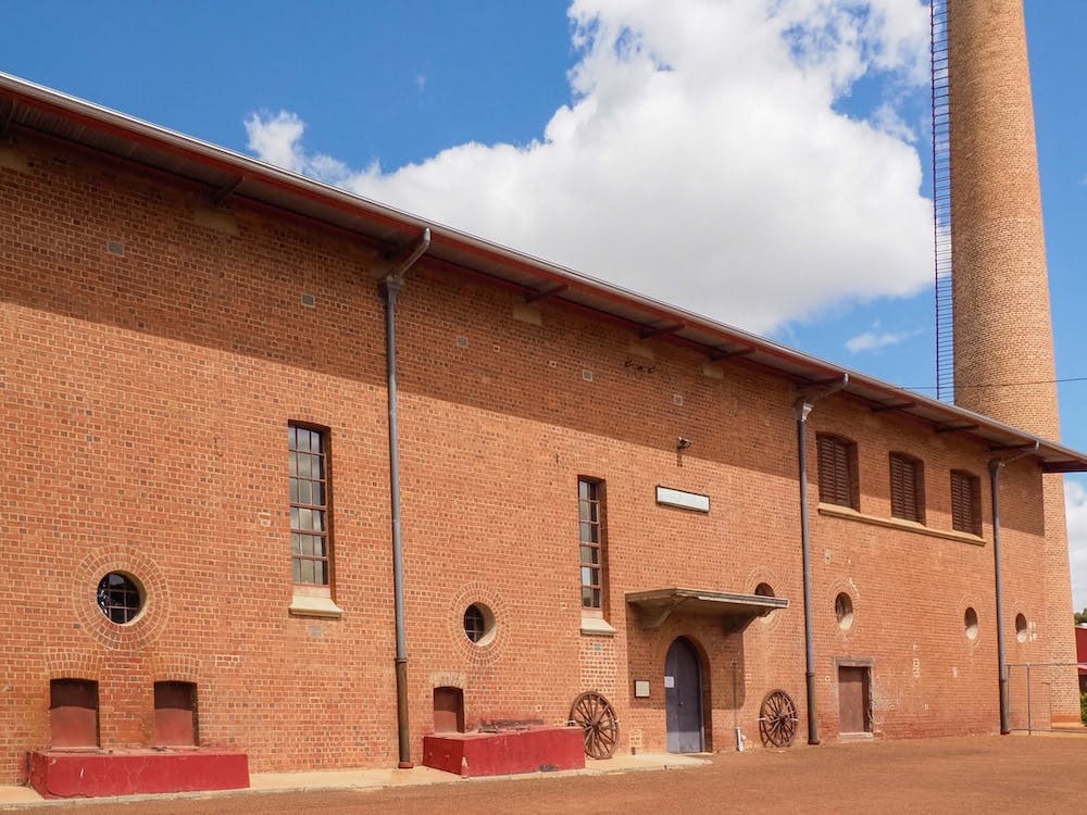
No.3 Pump Station in Cunderdin has been converted into a museum
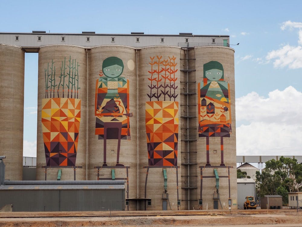
The PUBLIC Silo Art trail also passes through Merredin
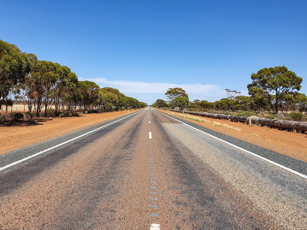
The trail runs alongside the Pipeline as it heads east
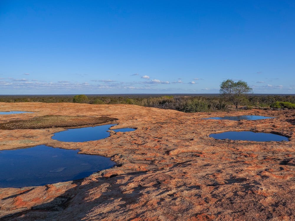
Gnamma holes on top of Boondi Rock. These naturally-forming water holes were an important water source for Aboriginal people who survived in these arid lands long before the gold-seekers arrived.
Subscribe to our free newsletter!
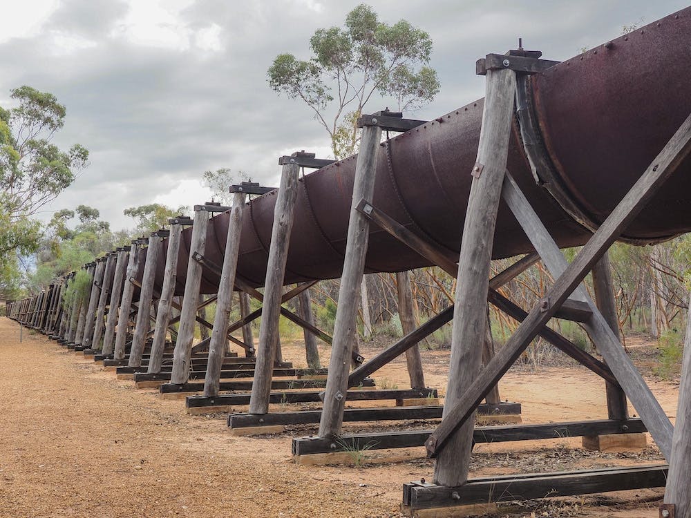
Karalee Aqueduct was built before the Golden Pipeline as a way to funnel water from a nearby rock and into a huge dam. It was an important source of water for men, horses, camels and eventually the steam trains that followed
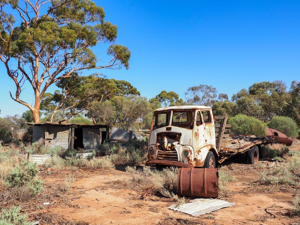
Jundee Mission was a government-controlled Aboriginal camp. While all the residents are long gone, there are still lots of interesting artefacts
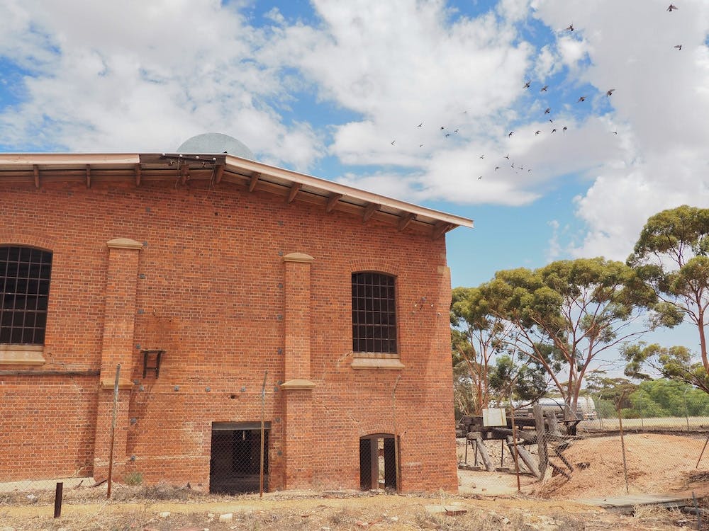
Merredin Pumping Station is closed to the public but you can still admire the imposing red-brick architecture from the street
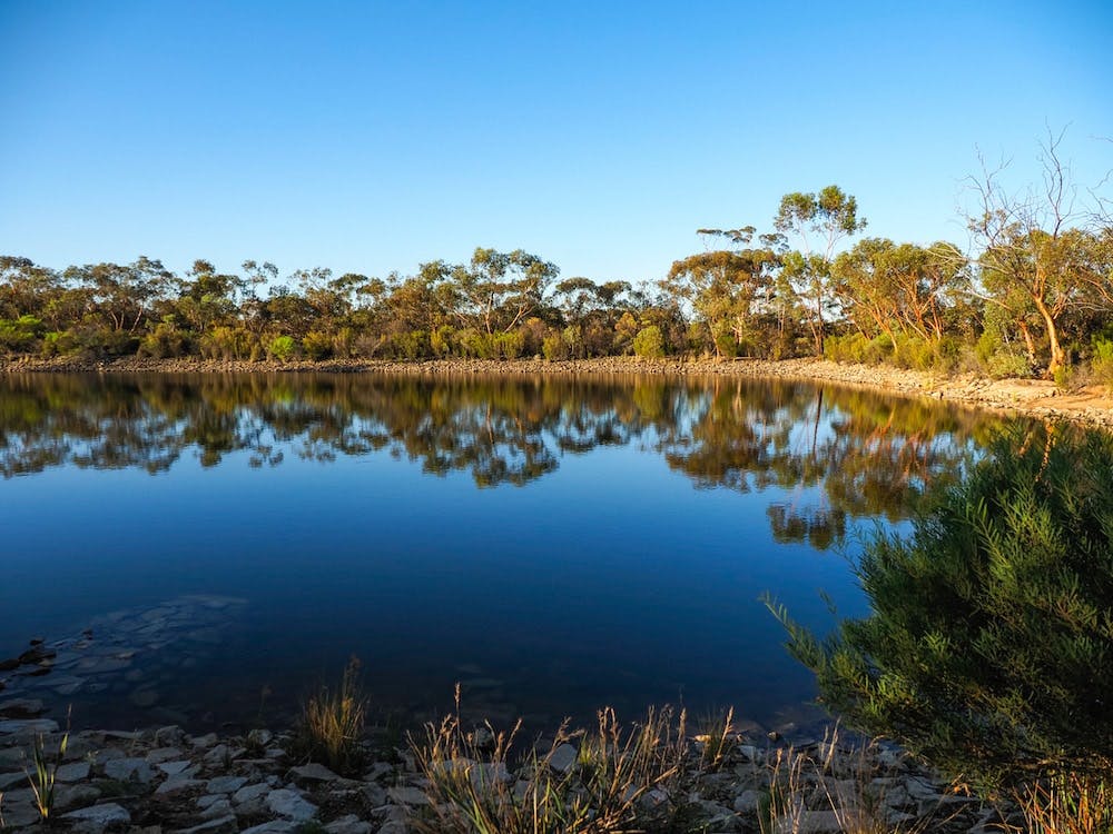
Boondi Rock is a popular camping spot
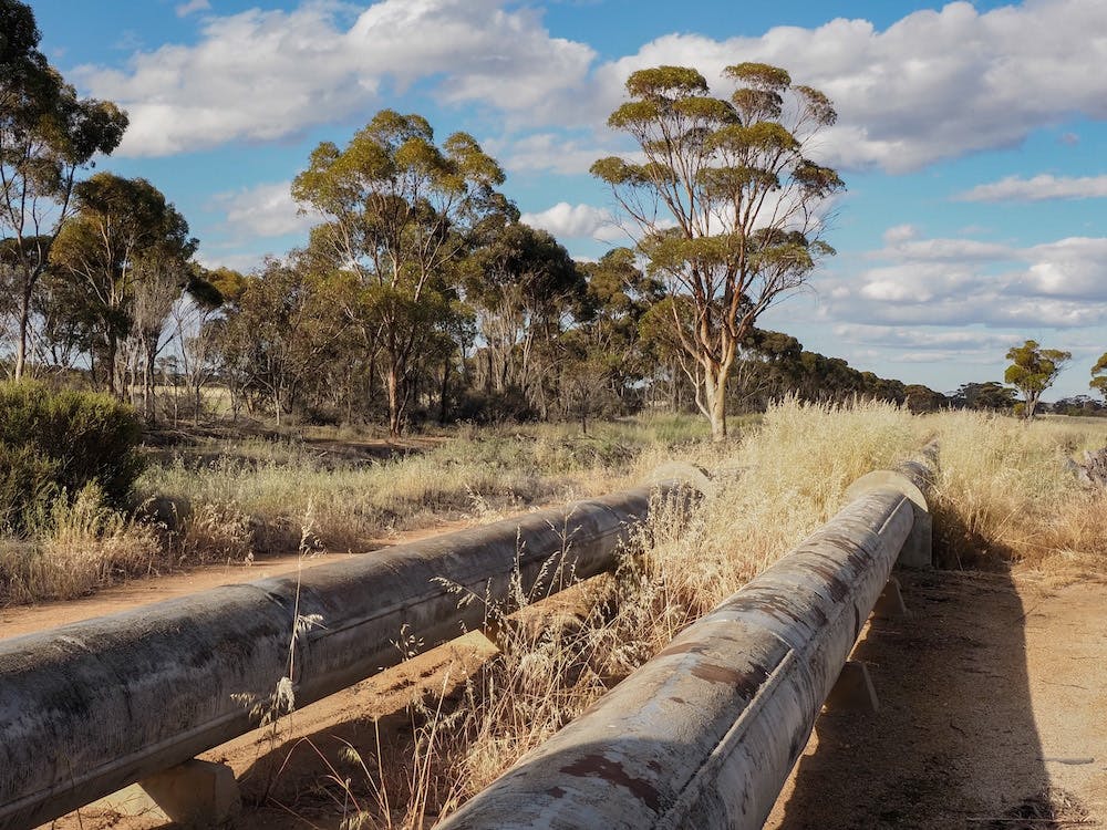
Image Credit: Cassie Wilkins