The 10 best hiking trails around Perth for beginners
Getting out there and hiking for the first time can be a bit daunting, and because we love hiking, we want to make this as easy as possible for new hikers!
Choosing the right trail will make your first few hiking trips so enjoyable, you’ll want to get out there again and again. However, hiking is not just about walking! As hikers, we need to not only be prepared physically but also in case of emergencies.
Firstly, be realistic about your physical capabilities. Each of the trails below are short and easy, but that’s all relative to your current fitness level. However building up your fitness to tackle these trails or longer ones just takes some regular exercise.
Always be prepared! We never expect anything to go wrong (and it rarely does) but particularly with some of Perth’s harsh weather conditions, you should be packing some essential gear into a backpack for any hike. Preparing the night before, including a good night’s sleep, means that you won’t forget anything before you hit the trail.
Stacey’s Loop
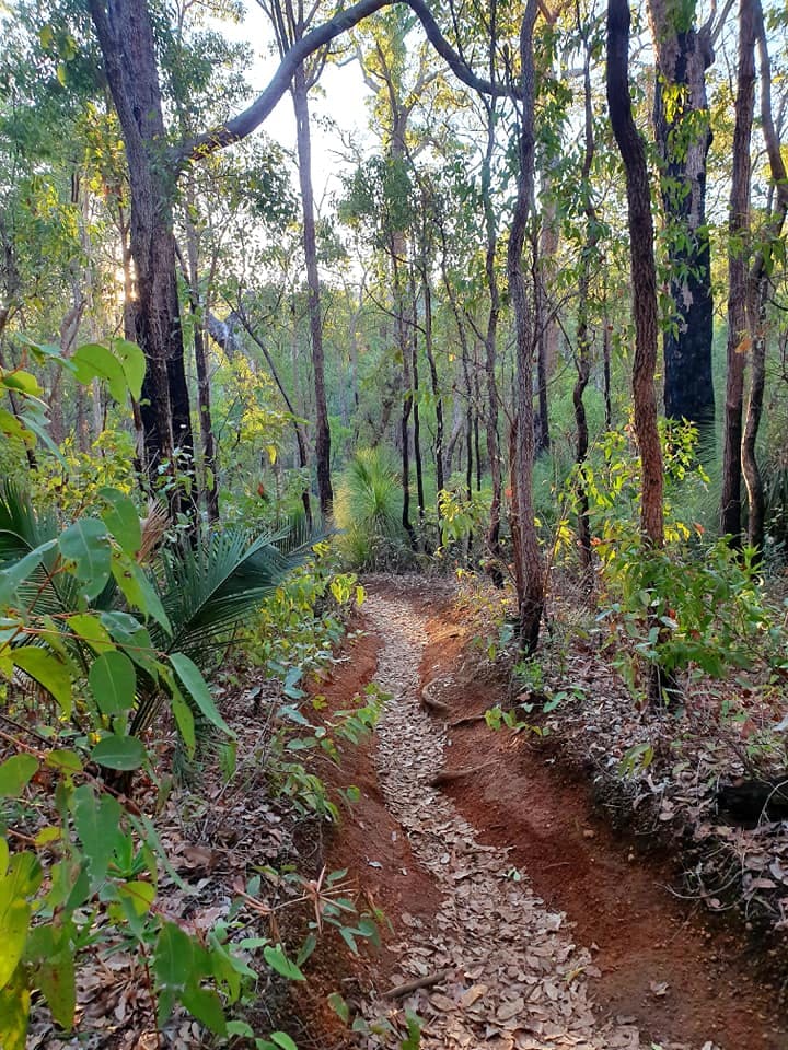
Stacey’s Loop, a 2km family friendly trail, is a perfect beginner hike. This short but sweet trail in Serpentine National Park winds through jarrah forest filled with fallen hollowed trees, bracken ferns and grass trees. The fallen trees are perfect for kids to climb and explore and definitely ignite their sense of adventure!
The trail head is on Atkins St, Jarrahdale with ample parking across the road at the cemetery. Our preference is to hike the trail in an anti-clockwise direction because this means you start out being completely immersed in dense forest!
After about 300m you’ll come across a huge Marri tree that is burnt but still living! The size of this tree is very impressive and you’ll be sure to stop to admire it and take a photo! A little further along the track you will come across an old burnt out tree hollow and fallen trunk on your left which is ideal for the kids to climb and explore!
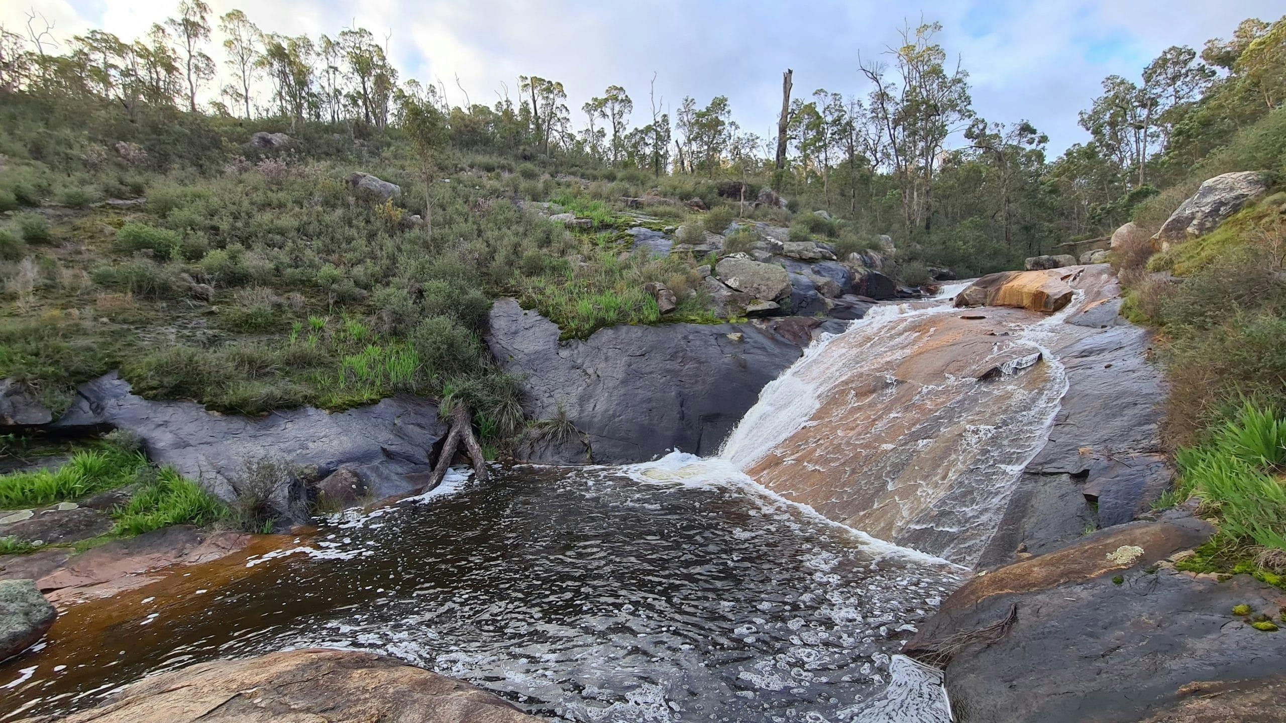
Just after you cross a wooden bridge near a small waterfall you have the option to go straight ahead (the official trail) or a small track to the right that follows the brook to a lush ‘secret garden’. Beyond the secret garden is a granite outcrop which is a fantastic vantage point to sit back, relax and take it all in!
With such a diverse range of gorgeous scenery, Stacey’s Loop is one of my favourite little Perth hiking trails!
Whistlepipe Gully
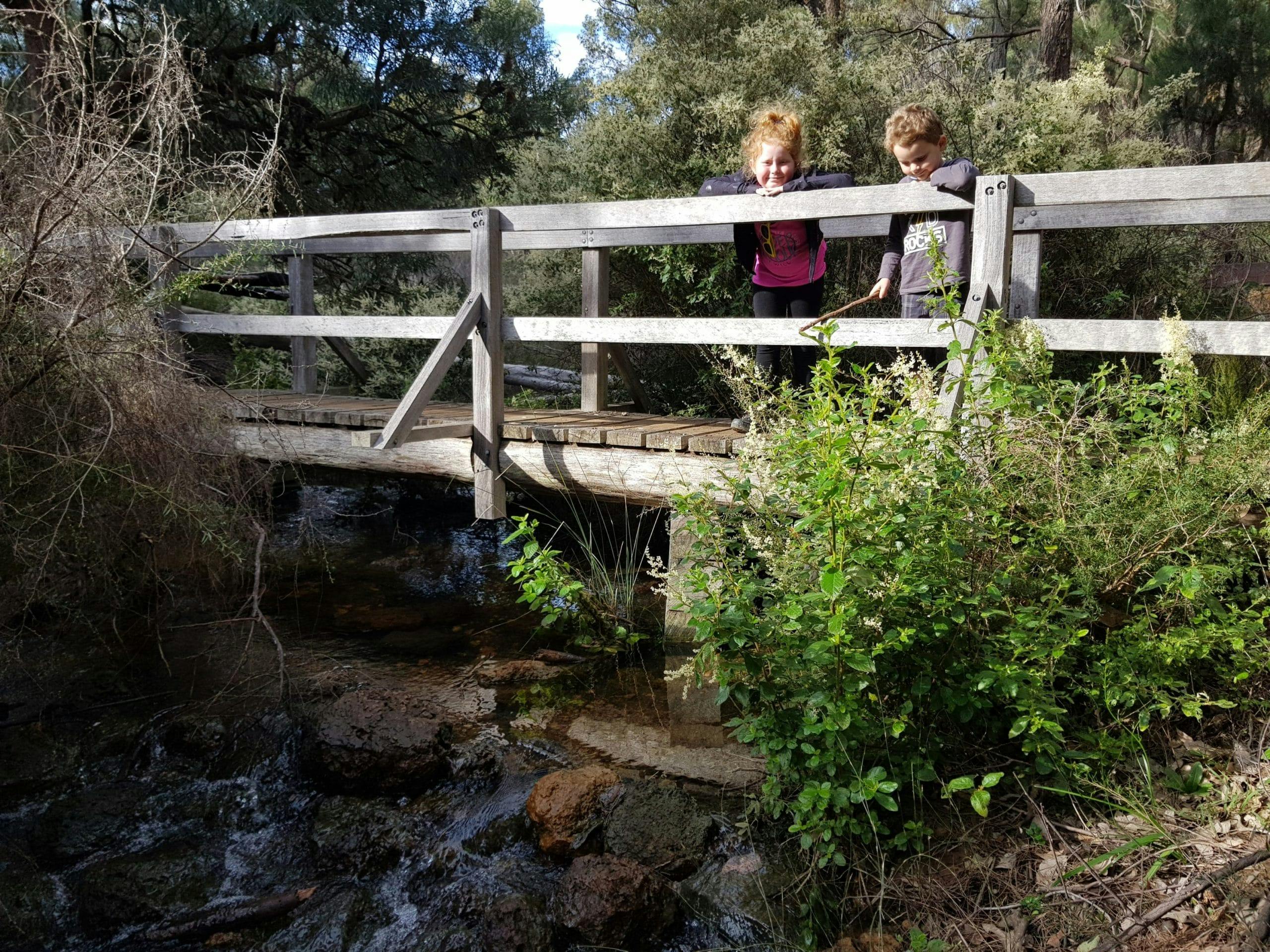
The 3.5km Whistlepipe Gully Trail is perfect for everyone, including kids and dogs. The scenery on this hike is very pretty with the banks of the gully lined with lush green foliage, paper-bark trees and a variety of wildflowers.
Whistlepipe Gully in Kalamunda has water all year round as the creek is fed from a pipeline. It’s much drier in summer but it’s still a great place to hike near water for the sake of a few cooler degrees. Located in Mundy Regional Park in the Perth Hills, the Whistlepipe Gully Trail commences at the end of Lewis Rd in Forrestfield. There is only a small car park here and in Winter and Spring the trail is very popular so unless you’re early, expect to be parking a couple of hundred metres down the street.
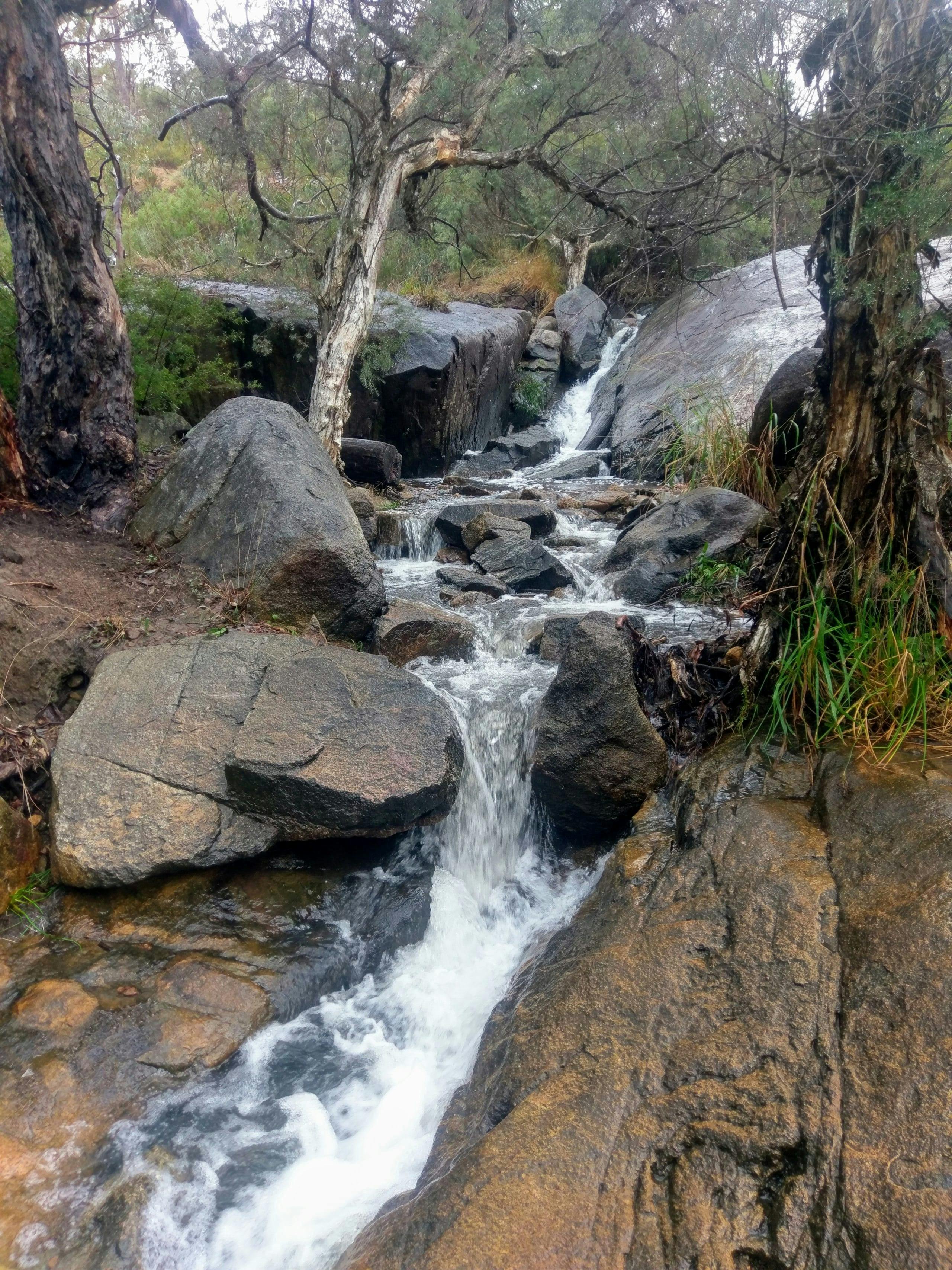
There are two bridges that allow you to cross over and return down the other side of the gully, making the trail shorter if the littlies get tired. As you follow the trail alongside the creek you’ll soon reach a giant granite outcrop with water cascading down it on your left, this is a great place to stop and explore as you can get quite close to the water’s edge here and it is very picturesque. After crossing the gully on the bridge you continue down the left hand side of the stream to the ruins.
These old concrete foundations are from the mysterious Wallace Greenham House that once stood here. Wallace Greenham was the outstanding and innovative architect that built this fascinating house in 1963. The house was built in a Japanese inspired style of architecture called Organic Architecture which means to promote harmony between habitation and the natural world. Wallace incorporated the granite boulders in its structure to connect walkways across the stream.
If you follow the trail right to the end you’ll enter what feels like a rain forest with a deep gorge complete with ancient fallen trees covered in moss and vines. It really is spectacular!
Bells Rapids
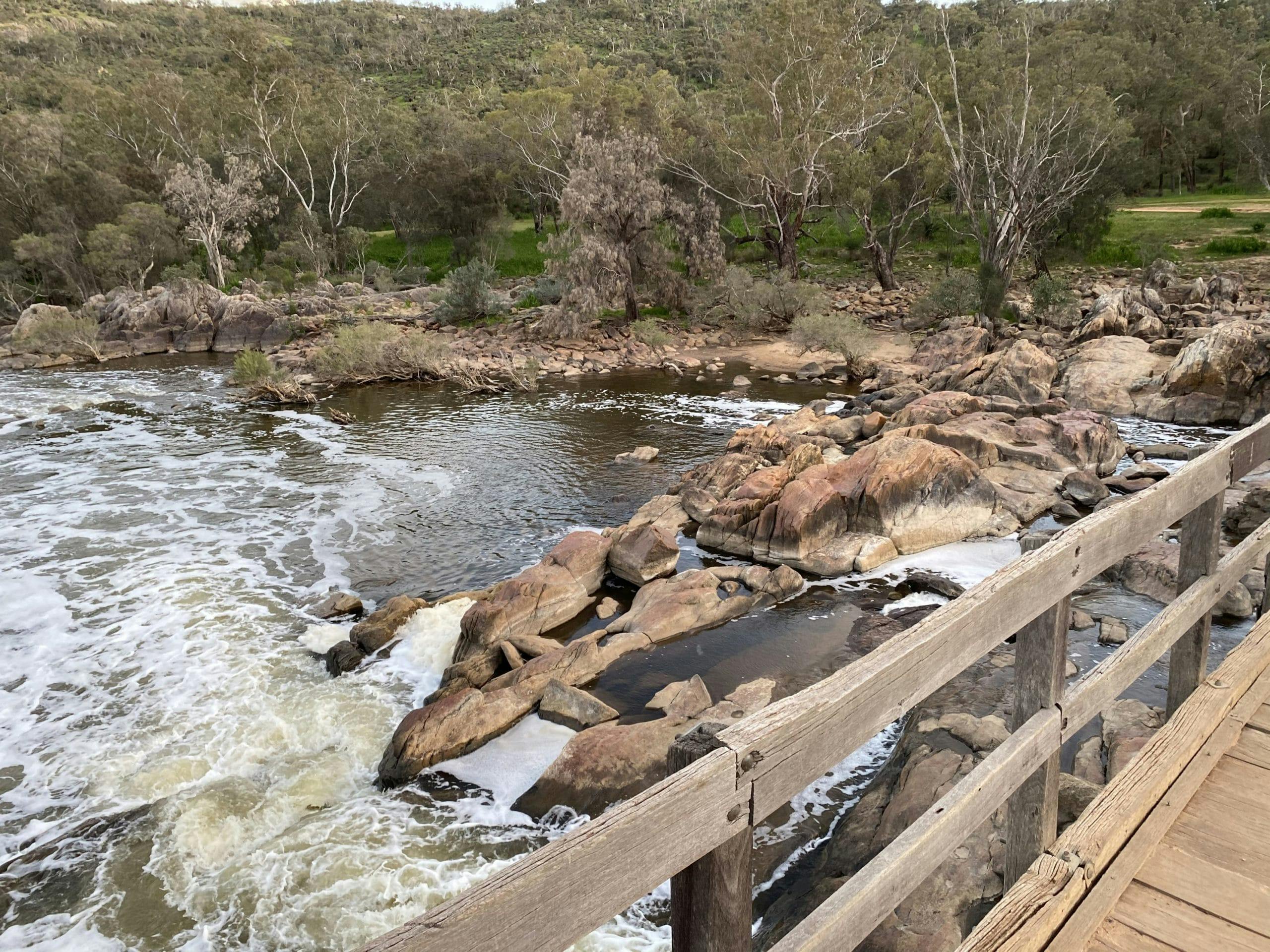
If you’re looking for a short loop trail that gets the blood pumping whilst offering spectacular scenery – Bells Rapids is the one for you! Bells Rapids is a great beginner trail and is both family friendly and dog friendly! This hike provides spectacular scenery with views over the Darling Scarp, Swan Coastal Plain and into Walyunga National Park. In Winter the lush green grassy riverbanks and rocky rapids are a superb spot to stop for a picnic to take it all in.
This 4.5km loop trail commences at the end of Cathedral Ave and is made by linking the 1.5km Riverwalk Trail and 3km Goat Trail. The official start point is just after you cross the bridge over the Swan River which is the perfect place to stop and admire the fierce waters churning during the Winter months. From here you can turn left for the gentle Riverwalk Trail or head right to tackle the steep but rewarding Goat Trail (which we highly recommend).
The Goat Trail isn’t well marked in places so you’ll have to trust your instincts a little. As you hit the fence line, turn left and go uphill. This is your first climb for the day, and although it isn’t a long climb the gradient will sure get the blood pumping! Luckily there are great views over the valley and across to the trail line that are worth stopping for (to catch your breath). At the top of the hill, turn left and follow the fence line as the trail briefly descends before leading you into another great climb.
There are many fantastic vantage points along this section of the trail to stop and admire the superb valley views. Majestic boulders and granite outcrops are another great feature of this hike including the famous ‘Buttock Boulder’! The descent can be a little tricky and slippery in areas so make use of the ruts on either side of the trail to give you extra grip. At the bottom of the hill the Goat Walk trail links back with the River Walk trail and taking a left will lead you past the rapids and alongside the Swan River back to the bridge.
Bells Rapid, is situated at the edge of the Darling Range near Brigadoon, and is best known as a viewing spot during the Avon Descent. In late winter when the river is roaring the white water is a very popular attraction. In the drier months the rapids almost disappear, leaving behind an intricate path of glimmering rock, drift wood and calm pools.
The very scenic Bells Rapids Walk Trail offers views of countryside, coastal plains, and babbling rapids so is hard to compare to anything else in Perth. Whilst there is loads of parking available, it is a very popular spot on weekends during Winter and early Spring so be sure to visit early or midweek if you enjoy your hikes a little quieter.
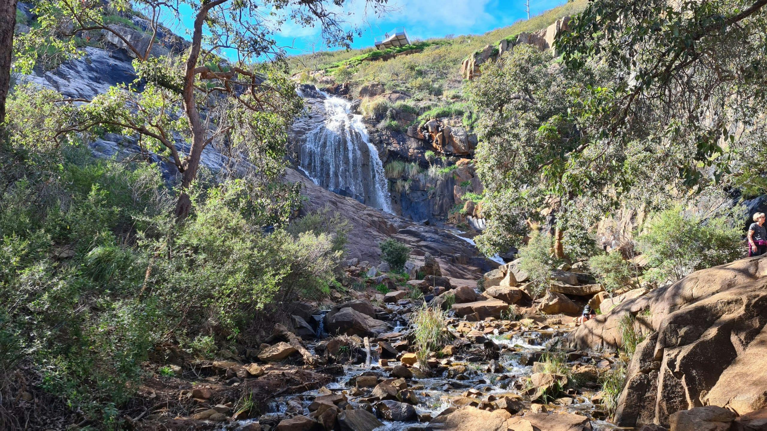
Lesmurdie Falls
Lesmurdie Falls, located in Mundy Regional Park in the hills east of Perth, is the largest and most impressive of all the waterfalls in Perth but it also includes five great walking trails.
The length of the trails vary from 640m to 3kms, with the Valley Loop Trail being the longest and our personal favourite! Setting off from Falls Rd car park there is a fantastic trail information board which provides a map and list of the trails, with duration and level of difficulty.
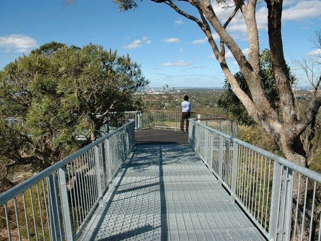
Following the pink markers, the trail takes you alongside Lesmurdie Brook as you head downhill on some concrete steps to the first viewing platform over the falls. As you approach the second lookout views of the Swan Coastal Plain and Perth city skyline take your breath away. Take a moment to sit and admire our beautiful city with the sounds of the water gushing below, you wont regret it! After filling your soul, continue your descent by skirting down the edge of the ridge, but don’t forget to look back at those falls!
The trail suddenly becomes very narrow and rocky as you make your way to the bottom of the valley. As you reach the babbling brook, the official trail takes you over the brook to continue on up the other side of the valley, but we think it’s a shame to miss out on exploring the foot of the falls so turn right here and follow the trail alongside the stream until you reach the base of Lesmurdie Falls.
This is a very special place during Winter and Spring with the Karri Hazel in bloom providing a beautiful fresh scent combined with the sound of the water cascading around you as you rock hop and explore the impressive black and orange rocks of the falls.
Once you’ve soaked in the ambiance, make your way back to the trail intersection, and cross the brook over to the other side using the rocks or fallen tree to get across. If the water is too high or you’re not feeling too adventurous you can continue up the trail for 100m to the Palm Terrace Car park and cross here. After crossing (and hopefully having dry shoes still) you’ll ascend up the valley on a short but steep narrow and rocky trail. As you reach the top there is a lookout with a rock seat which provides the perfect pace to sit and admire the falls from another view point.
Following the pink markers through the top section you can expect to see a sea of colour when the wildflowers are blooming in August – October! There are also some fantastic granite outcrops and boulders through this section waiting for you to explore. The trail is quite well marked through here so following the pink markers will lead you back to Lesmurdie Brook where you then have the option of turning left and completing the Lesmurdie Brook Loop Trail or crossing the bridge and turning right back to the car park. There is a beautiful little waterfall here to give you one last WOW moment before you complete your loop by finishing the hike back at the Falls Rd car park.
Lesmurdie Falls is an absolutely epic waterfall! Being able to explore the falls from the top and the base plus admire it from anywhere in the valley makes the Valley Loop trail one of our favourite Perth beginner walking trails.
Please Note: The main start point of exploration for Lesmurdie Falls is the Falls Rd car park. There is a toilet block here as well as a couple of picnic tables nearby but be warned this area gets very busy during Winter and Spring weekends so head out early if you like to avoid the crowds. There is an alternative Start Point being the Palm Terrace car park, Palm Terrace (off Lewis Rd) in Forestfield.
Marrinup Falls
The Marrinup Falls Walk is a stunning circuit trail that meanders through lovely native bush and past some of Australia’s oldest rocks, exposed against the sides of the Darling Scarp near Dwellingup, south of Perth. Enjoy a serene meander with scenic views, birdlife, wildflowers in spring, native animals and waterfalls. The best time of year to see the falls flowing is during and just after the winter rains.
The start of this trail is located at the old Marrinup townsite which was destroyed by a bushfire in 1961. During World War II thousands of Italian and German POW’s spent time here cutting wood for Perth before being billeted out to Western Australian farms. The buildings no longer exist, but there are remnants of foundations, gardens and fencing to explore.
Following the trail clockwise from the 7.9km Top Trail, the trail can be shortened to about 4km by using the short course return route. It varies from narrow, challenging tracks with flat sections and hill climbs to true gravel roads. A few up and downs which can be slippery!
Located just outside of Dwellingup, from Pinjarra-Williams Rd take Grey Rd north (look out for Marinnup POW Camp signs) and follow this over the railway. Keep going until you see the sign for Marrinup Falls and turn left to follow Grey Rd all the way to the car park.
Head into Dwellingup to make a day of it.
Mundlimup Timber Trail
The Mundlimup Timber Trail in Jarrahdale starts at the 1890s timber tramway and features old methods of the timber industry from 100 years ago. Sitting on the Darling Scarp, surrounded by forest, Jarrahdale was Western Australia’s very first timber town. Today, its scenic woodlands, parks, rivers, orchards and vineyards offer a tranquil escape from modern city life, while its National Trust listed heritage gives you glimpses of a bygone country life.
The forest is regrowth jarrah and it’s amazing to see the recovery with reforestation. There is interpretive signage around the timber industry features such as the Log Landing and saw pit. It is an easy three kilometre walk through some narrow bush trails and the track is a compact surface with a gentle hill section, some occasional steps and a small bridge. In Spring you’ll see a lot of wildflowers and the picnic area is perfect for a family day out.
Turn off Jarrahdale Road onto Balmoral Road and then follow the signs all the way to the small car park. Be on the lookout for cyclists as the access road off Balmoral Rd forms part of the Munda Biddi. A map and large wooden board greet you at the car park.
Given its close proximity to the town centre it makes for a great day trip to the area if you combine it with a trip to the Jarrahdale Railway Heritage Trail or Serpentine Falls.
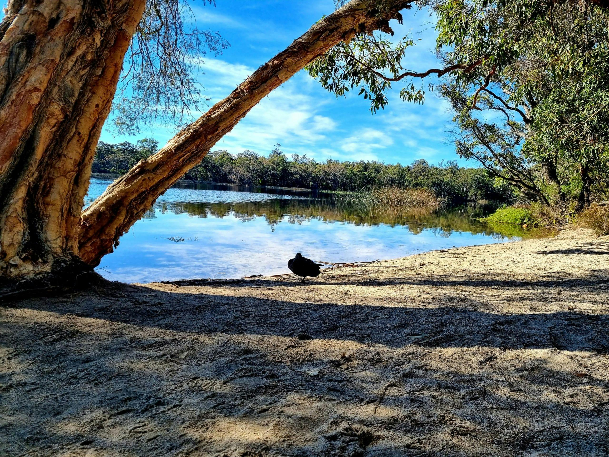
Lake Leschenaultia Loop
This 3km trail around the lake is flat, making it an easy hike and suitable for prams and children. It’s a popular area, even when the lake is too cold to go swimming, with the sounds of birdlife, butterflies, frogs and scenic views. The forest is a mix of Jarrah and Marri trees with a smattering of Wandoo forest, and during winter there’s a lush undergrowth of grass trees, lots of wildflowers in spring and heavily shaded during summer.
Lake Leschenaultia is not a natural lake and was constructed in the late 1800s to supply water to the steam trains that worked in the area. It served this purpose until just after WWII when it was then turned into a recreational area for locals.
With no public swimming pools in the area until the 1960s, many locals learned to swim here and so it holds a lot of historical memory in the area. Lake Leschenaultia is near Chidlow, about an hour east of Perth. Take Great Eastern Hwy past Mundaring and turn onto Old Northam Rd. From there follow the signs to Lake Leschenaultia, which is located off Rosedale Rd on the north side of the lake.The trail starts and ends from the car park on the Northern side of the lake.
Lake Leschenaultia is open all year round and is a popular recreational area offering walk trails, bbq facilities, swimming and canoe hire in summer. With this much to do it’s worth making a weekend of it and camping overnight.
The gates open at 8.30am (8am on Saturday and Sunday for breakfast at the cafe) and closes at sunset all year round.
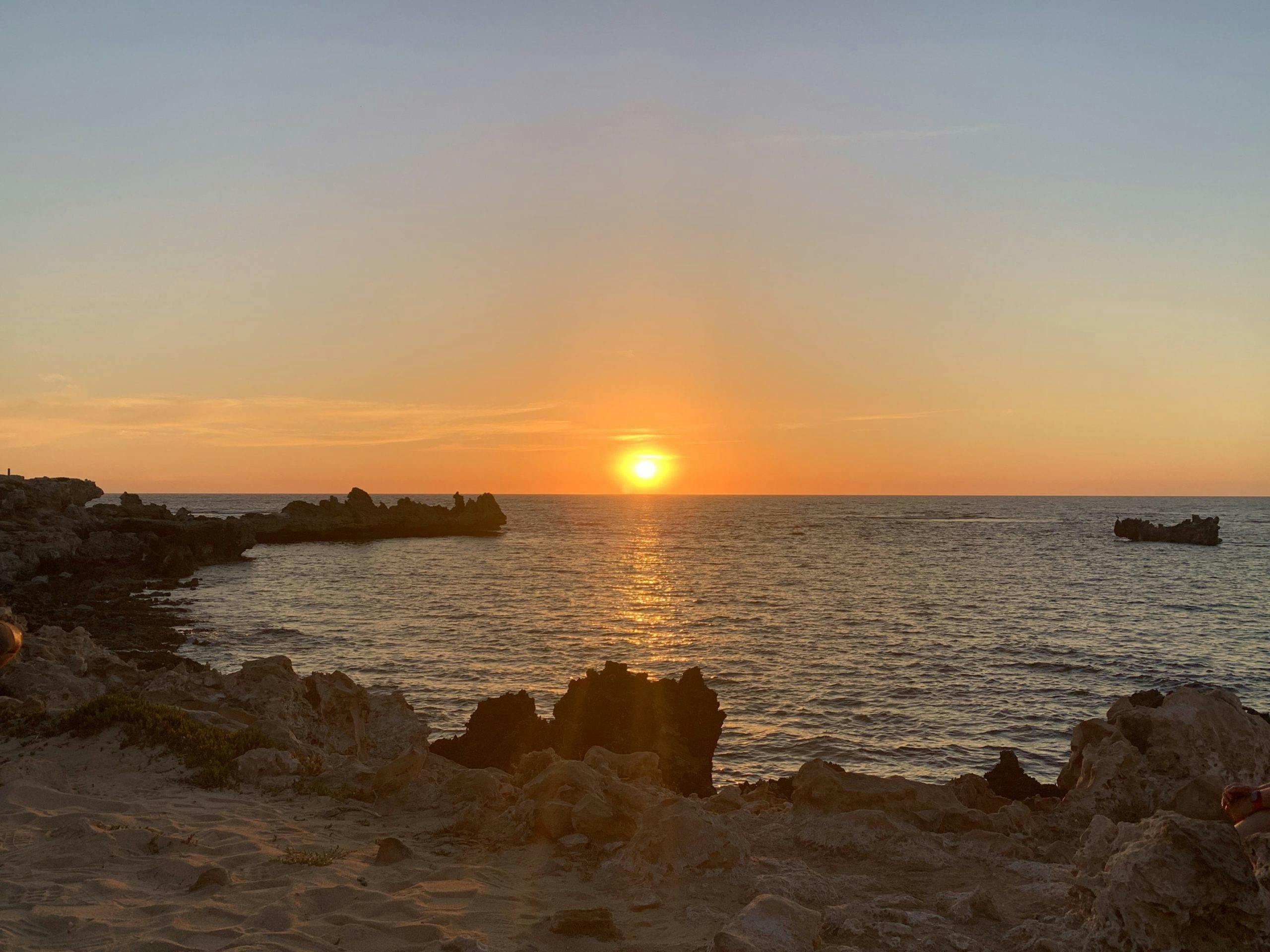
Point Peron Loop
Cape Peron, locally known as Point Peron, is known for its secluded sandy beaches, dramatically rugged limestone cliffs, offshore reefs, panoramic ocean views and a cantilevered lookout over the cliffs. The Point Peron area is home to many different trails. All of them are fairly family friendly and there are some beautiful coves and look-out points to explore; as well as the ruins of WWII batteries and bunkers originally built to defend the coastline and Garden Island.
Starting from the carpark at the end of Point Peron Road in Rockingham, this walk takes you on a circuit around the coastline of Cape Peron.
There are many beautiful coves and lookout points to explore, as well as the ruins of WWII batteries and bunkers originally built to defend the coastline and Garden Island (although it never saw action). This short but picturesque loop walk offers amazing views of the bay on all sides, and can be extended by exploring all the different coves and lookout points.
This is an easy walk, suitable for most ages and fitness levels. The trail is mostly along a wheelchair and pram friendly worn concrete path, with some sandy sections and a gently undulating terrain. Dogs are allowed as well, as long as they’re on a leash.
A final couple of notes on Point Peron. The onshore winds during winter are pretty stiff creating some fabulous sprays as the waves crash against the rocky shore. And if you’re looking for a great sunset photo moment, Point Peron offers crisp skies and craggy limestone features.
Bold Park
With over 15km of walking trails and ten different lookouts with expansive city and coastal views, Bold Park also includes Camel Lake, wetlands and an array of wildflowers during spring. Bold Park has an impressive biodiversity, Banksia and Tuart woodland covers most of the park with outcrops of limestone heath and a wetland of Flood Gum around Camel Lake. Despite being so close to the city, there’s also an abundance of wildlife.
The park itself has a maze of trails that are all linked, ranging from less than 1km to over 10kms (if you stroll on from one to another), so there’s something for everyone. No matter how many times you visit, you’ll never walk the exact trail, so there’s always something new to discover.
Covering 437 hectares, Bold Park is one of the largest remaining areas of bushland within urban Perth. It was declared an A-class reserve in 1998 for its high conservation, landscape and recreation.
Directions – The car park is located at the top of the hill on Scenic Drive that comes off Oceanic Drive. During peak times it may be difficult to get a park so there is another car park located near the corner of Perry Lakes Drive and Oceanic Drive.
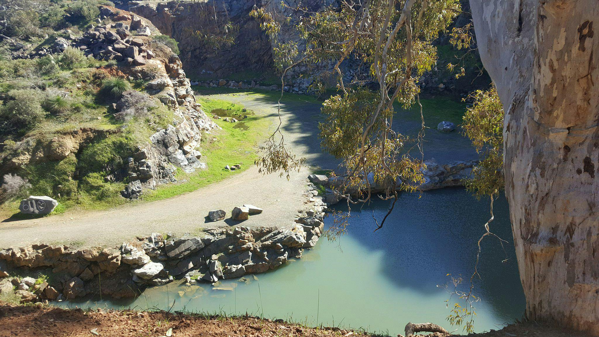
60 Foot Falls
The Ellis Brook Valley in Banyowla Regional Park is a beautiful place just on the edge of the city and on the Darling Scarp. There are four walk trails catering for every fitness level. Sixty Foot Falls is the hardest trail but you’ll be rewarded with spectacular views of the city. The waterfall flow depends on the rainfall during winter months. It can range from water pumping over the edge, plunging into the pool below, a trickle or nothing at all.
Ellis Brook Valley is known for being the richest wildflower location in the Perth metro area with over 500 species in a beautiful hidden valley only minutes from Gosnells. It’s also home for many birds, including cockatoos, parrots, pardalotes, splendid fairy wrens and wedge-tailed eagles, just some of the over 116 species of birds in the area. It is also home to our furry residents including kangaroos, echidnas, possums, bats and other native wildlife.
Subscribe to our free newsletter!
From Tonkin Highway turn east into Gosnells Road East, then right into Pitt Road. Turn right onto Hayward Road. Turn left into Quarry Road. Turn left into Rushton Road. Proceed for 1km to Honeyeater Hollow and a further 1km to the Ellis Valley Head car park. From here you will see the information board with details of all the different trails including Sixty Foot Falls.
There are Dieback Stations before you enter and we ask that you make use of them to help stop the spread of this soil-born bacteria that kills our trees. Sixty Foot Falls is a short but steep climb to the top of the spectacular Falls, with amazing views of Perth and the valley along the way, before descending past the old Barrington Quarry where old workings provide a window into the geology of the area.
The waterfall flow depends on the rainfall during winter months. It can range from water pumping over the edge, plunging into the pool below, a trickle or nothing at all. Springtime, from mid-September to early November, is the best time to visit the Valley, with the wildlife and flowers at their peak and after good rainfall.
Along with being kid friendly this trail is also dog friendly which makes it a real winner in our eyes!
This article was originally published by Off The Beaten Track WA, Perth’s leading premier Hiking Experience & Adventure Tour operator. If you’re just dipping your toe into this hiking thing, they’ve got you covered – from what to wear, what to take and how to choose your trail in their Beginner’s Guide to Hiking.