The Top 10 Perth Hiking Trails Over 10kms

Hikers often reach a point where we want to hike a little further afield!
Sometimes it’s to challenge ourselves physically and mentally, to spend more time in nature in our beautiful Aussie forests, for some overnight hiking or to build up our fitness for multi-day hikes.
There are a lot of amazing longer trails around the greater Perth area and here with the help of Off The Beaten Track WA (OBT) we’ve put together a list of our favourites.
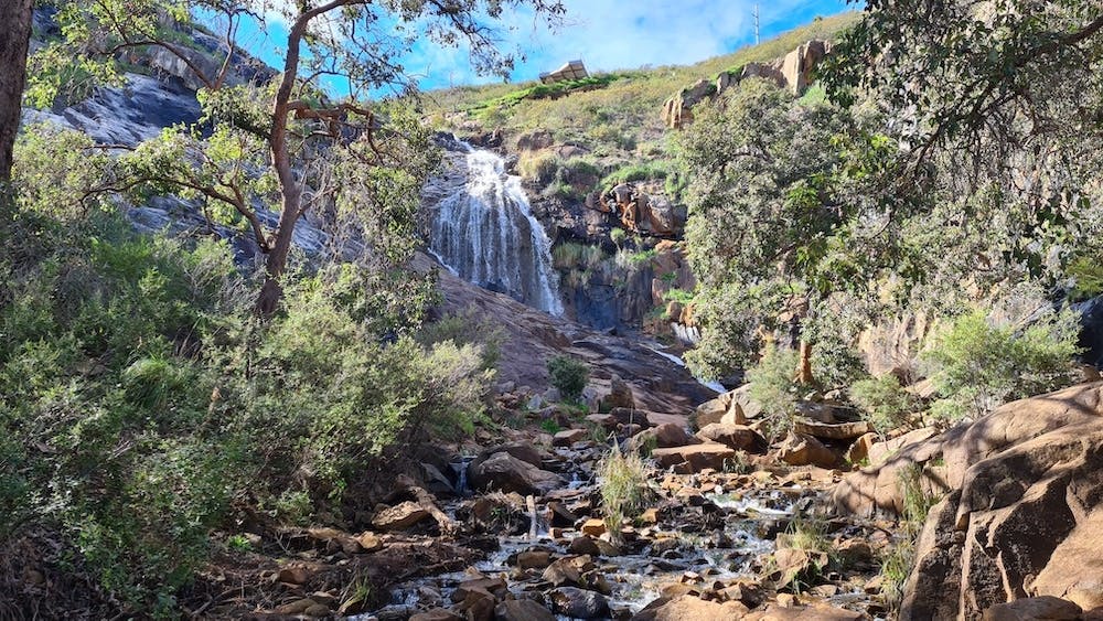
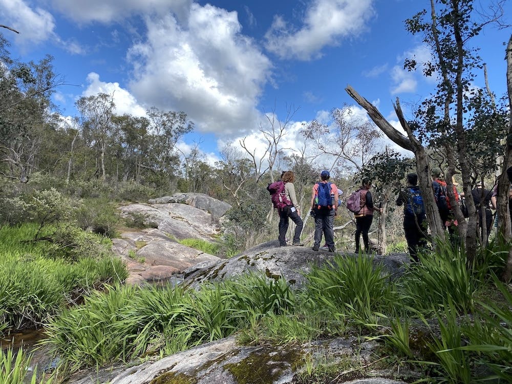
Falls & Gully – Mundy Regional Park (Waterfalls, Wildflowers & Wandoo)
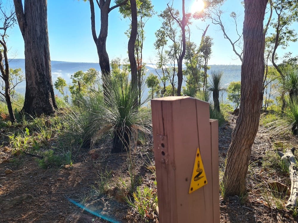
Start From: Setting off from Falls Rd car park there is a fantastic trail information board which provides a map and list of the trails, with duration and level of difficulty.
Distance: 10kms
Falls & Gully is the ultimate Mundy Regional Park Hike. This hike combines two of Perth’s best smaller trails: connecting the Lesmurdie Falls Valley Loop with the Whistlepipe Gully trail to create a stunner of a track! Featuring Perth’s best waterfalls and cascades plus some short but steep hills and epic views of the Perth city skyline, this trail has it all!
From the top of the Lesmurdie Falls Trail you’ll get some picturesque views of the Perth city skyline and Swan Coastal Plain and surrounding valley before you head down to the bottom of the Falls for a view of one of Perth’s more spectacular waterfalls from below.
The scenery along the Whistlepipe Gully trail is spectacular particularly during winter and spring with the ambience of the trickling water, paper-bark trees and blossoming wildflowers.
This route is an OTBT original, so check out their Upcoming Tours to experience it!
Mt Cooke Loop
Start From: Heading South, 16.5kms past the Jarrahdale Rd turn off along Albany Hwy turn left into the Mt Cooke Pine Plantation down a gravel track. When you get to the end (T-junction) turn right and follow this gravel road (Cooke Rd) for 1km. There is a small carpark on the left, park your car here.
Distance: This 10.5km/4hr loop trail will take you along the Bibbulmun Track over the peak until you reach the Mt Cooke Campsite, from there it is a relatively flat 6km through Jarrah Forest back to the start point. Be prepared for possible changes in weather; the summit ridge (especially on the south) is quite exposed and can get quite cold and windy.
Mt Cooke is the highest hike-able peak in the Darling Ranges and is definitely one of our favourites!
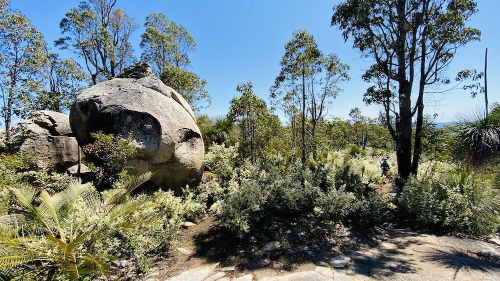
Unlike its buddies Mt Cuthbert and Mt Vincent, Mt Cooke features around 3km of trail along the main ridge of the summit and spectacular views in all directions. Within the first 5 minutes of this trail you will find yourself ascending up the South side of the monadnock and will be immediately impressed by large sloping granite outcrops and giant boulders. If you are lucky enough you will even find the elusive Mt Cooke Cave and be able to leave a note in the ‘Cave Book’ (hot tip: the cave is on the South side of the ridge, look for the ‘split boulders’ that face East).
Dwellingup – Etmilyn Return
Start From: Dwellingup Trails & Visitors Centre
Distance: 20kms return
This trail is a combo of narrow winding trails and some 4×4 tracks on a section of the Bibbulmun Track between Dwellingup and the Etmilyn Train Station, an old 1920s station along the timber line.
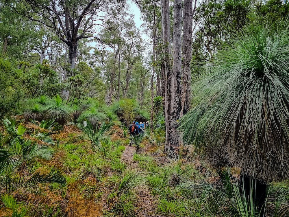
You can expect stunning Darling Range forest of native jarrah, banksia, grass trees and marri eucalyptus trees. When you reach the train station you’ll find a 15 minute nature trail at Etmilyn full of stands of blackbutt, jarrah, grass trees, red gum, and banksia.
When you-ve finished exploring the old abandoned train and station, jump back on the Bib for a return hike to Dwellingup.
From the Dwellingup Trails & Visitors Centre, follow the Bibbulmun waugal markers into the forest to enjoy this hike!
Sullivan Rock – Monadnocks
Start From: Sullivan Rock Car Park, Albany Hwy, Mt Cooke
Distance: 16kms return via firebreak or back over peaks!
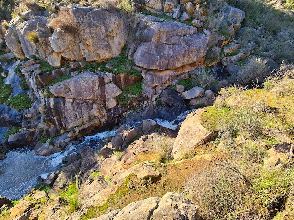
Sullivan Rock to Monadnocks is arguably the best day hike close to Perth! This 16km/5hr return hike in the Darling Ranges features a variety of scenery, great views from twin peaks and is a fairly challenging section of the Bibbulmun Track.
The trail starts at Sullivan Rock which is a giant granite rock covered in delicate moss, a real delight at sunrise, so I encourage you to get started early. Follow the rock cairns over Sullivans until you get to the intersection, at this point go straight to continue on the Bibbulmun to Mt Vincent. A short trek along a bush path leads you to the first climb of this hike, Mt Vincent. The views to the South West during the ascent are stunning and worth stopping for and as you reach the peak the views to the East are quite spectacular. Continue on, and not too far into the descent you will be surrounded by lush Jarrah & Ghost Gum forest filled with banksias and grass trees, on a cold wet day this valley feels quite mystical! The scenery continues on this trail as you start your next ascent, Mt Cuthbert, the rock cairns will lead you to the impeccable views of this peaks’ rocky summit! From here it is another steep but relatively short descent back on the trail that will eventually lead you to the Monadnocks Campsite. To return you can retrace your steps making this a four peak hike or follow the 4×4 track back to Sullivans.
It is very rare you get the sense of accomplishment from climbing two mountains, which makes this part of the Bibbulmun Track a real treat!
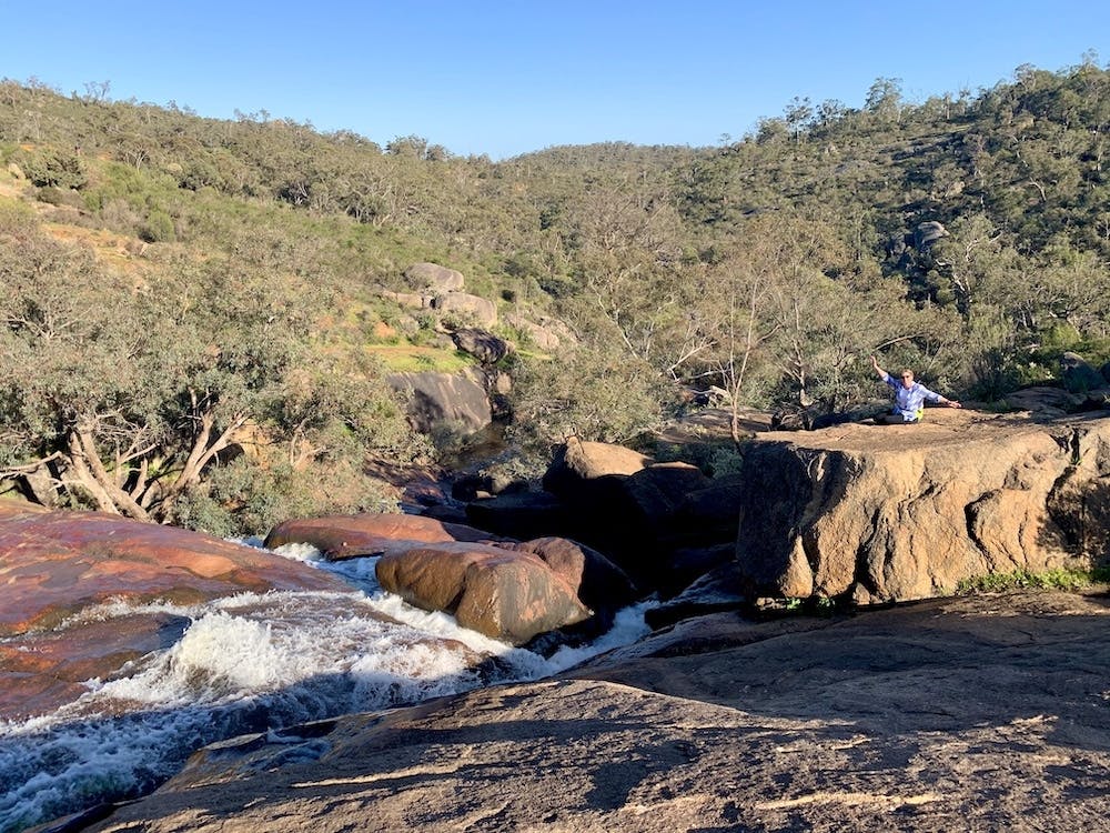
Kitty’s Gorge
Start From: Jarrahdale Cemetery, Atkins St, Jarrahdale or Falls Rd, Serpentine
Distance: 16kms
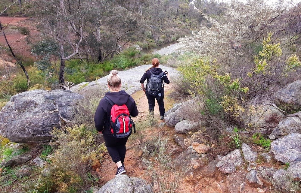
Kitty’s Gorge is one of our favourite hikes and really does have it all! This 16Km return hike follows the Gooralong Brook and Serpentine River so you can expect to see plenty of waterfalls, granite outcrops, lush jarrah forests, an old pine plantation, an abandoned heritage farm cottage plus so much more.
Parts of this trail include gravel tracks, single file trails, getting across large granite outcrops and over the odd tree. Much of the trail follows the Gooralong Brook and Serpentine River making this trail best after winter rains when the water will be flowing and the low level flora will be lush and green.
This well-marked trail can be steep and tricky at times; between the inclines and the length it’s a great challenge and will take you around 4-5hrs to complete.
You can access this hike from Serpentine Falls carpark which will make the first half of your hike uphill – or opposite the cemetery in Jarrahdale, where your first half will be downhill.
An early morning start will greet you with some very easy-going roos (great for photo ops!) particularly if you start from Serpentine Falls.
Note though that there is a National Park Fee starting from the Serpentine Falls entry and no access through the Park’s gate prior to 8am. There is no entry fee from the Jarrahdale entrance.
Read our full guide to Kitty’s Gorge here!
Numbat Trail
Start From: Paruna Wildlife Sanctuary
Distance: 12Km/4-5hr
If you’re looking for a challenging day hike within an hour from Perth, then the Numbat Trail in Paruna Wildlife Sanctuary, Avon Valley is for you!
The Numbat Trail is the longest of three trails that Paruna has to offer and right from the start you can see why it has a good reputation. The start of the trail will take you over a boardwalk to a mysterious looking lake (dam) filled with desolate grey trees. Onwards from the eerie marsh the trail starts to incline through the gorgeous White Gum forest and the smell of Eucalyptus is ever present. Soon you will reach the first of many quick boardwalk diversions that take you to a lookout with views over the sanctuary. From here a small trek through more Wandoo and Marri woodlands will lead you to the valley ridge and views of the Avon River, railway and a picturesque landscape that needs to be seen, to be believed.
A series of switchbacks leads you down to the impressive Paruna Gorge and its viewing platform – we highly recommend spending some time here to take it all in; the rocky pools and granite cliffs with a backdrop of hilly pastures is like no other. Before too long you will find yourself on a descent through a shaded valley, lined by big granite boulders and wildflowers leading you to a split in the trail. A left here will have you complete the Quenda Loop Trail (6.5Km), however carrying on with the Numbat Trail means we turn right and are quickly faced with another steep incline of steps.
This 12Km/4-5hr trail takes you on a journey of undulating terrain and features what feels like over 1000 steps and endless switchbacks, but the scenery and views are well worth it and make for an excellent cardio workout. There has been so much love, thought and care put into this well-marked trail and I can see why it is arguably one of the best Perth day hikes.
Please note: You must book your entry ticket into Paruna via Australian Wildlife Conservancy If you do not do this you can’t access the grounds as it is gated. Current entry fee is $10pp.
Read our full guide to Paruna Wildlife Sanctuary here!
Eagle View
Start From: Rangers Station, John Forrest National Park
Distance: 15kms
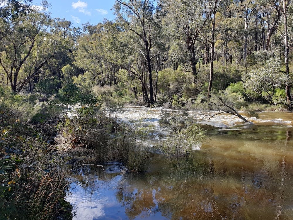
Starting at the Rangers Station the trail takes you alongside Jane Brook, underneath the Railway and down to the National Park Falls via a wildflower lined trail which is truly superb. The National Park Falls are a treasure in themselves and a great spot to stop and take in the natural beauty of your surroundings.
From the falls you can either choose to follow Jane Brook or the Ridge for the 250m vertical climb up to the Eagle View Lookout. I highly recommend following the narrow and windy Jane Brook trail as it requires rock climbing, features granite outcrops and the serenity of hearing the brook flowing adds a really special touch! Please note – this option does require some bushwalking experience and a reasonable level of fitness!
The climb via ‘The Ridge’ is quite gradual and not difficult. Being surrounded by a variety of gorgeous wildflowers and the sweeping views of the valleys that John Forrest National Park provides, make it a very rewarding climb. Once at the top, there are many granite rocks you can take a seat on to enjoy the impeccable views over the Swan Coastal Plain to Perth that the Eagle View Lookout offers.
From the lookout the trail weaves its way through open heathlands and down to the bottom of the valley alongside Christmas Tree Creek, which is a highlight of this trail especially after some decent Winter rainfall. Once you cross the creek the trail immediately starts to incline through jarrah-marri-wandoo forests, typical of the Darling Scarp. This section has lots of hilly ups and downs and certainly makes for a great workout with incredible views! The final section is mostly downhill on a wide gravel track that makes its way back towards Jane Brook and Hovea Falls.
As Eagle View is a loop trail, it can be completed in any direction, but following the yellow triangle eagle markers in a clockwise direction is your best bet, as it gets the bigger climbs out of the way early on. This 4-5hr hike will take you on a journey of undulating terrain through unparalleled scenery.
Read our full guide to John Forrest National Park here!
King Jarrah
Start From: Nanga Mill, which is 10.5 kilometres from the Lane Poole entry station, Murray Valley Road, 18km from Dwellingup
Distance: 18km loop
The King Jarrah trail combines easy walking along the valley floor and a winding path through fabulous jarrah forest high above the river. It traces the former transportation routes of the once vibrant timber industry. The much prized hard woods of jarrah, marri and blackbutt saw a proliferation of timber towns in the late nineteenth century and were an important source of employment for the early pioneers.
This 18km guided hike can be quite challenging with some steep rocky sections, but the last 11 kms is relatively flat as it follows the Murray River on an old 4 x 4 track. You can expect to see plenty of wildlife and birdlife and hear the water flowing along the river in Lane Poole Reserve, Dwellingup.
Estimated to be between 300 and 500 years old, you’ll find the ancient King Jarrah Tree on this trail, standing approximately 36 metres tall and surviving bushfires, storms, lightning strikes – one of the absolute highlights of this trail!
Kalamunda – Mundaring Weir on the Bib
Start From: Kalamunda Bib Track, Northern Terminus
Distance: 20kms
The Kalamunda to Mundaring Weir section of the Bibbulmun Track features steep rocky terrain, flowing waters, granite boulders, picturesque valley views and some of the most scenic sections of this world class trail! All combined in 20kms of hiking gold!
This section of the Bib takes you through the former golf course that is now known as Jorgensen Park and into Kalamunda National Park, follows the creek line of Piesse Brook, across Mundaring Weir, into Beelu National Park, finally emerging at Lake CY O’Connor.
It also offers a variety of landscapes from spectacular valley views, gorgeous granite outcrops which make excellent vantage points, lush mixed Jarrah forest and amazing views of Mundaring Weir before you cross over.
By the time you’ve finished this amazing hike you’ll be happy to stop off at the Mundaring Weir Hotel for a cold one and some great food.
This is an end to end hike, so you’ll need to organise transport back from Mundaring, or you could hop on the OTBT Tour that includes a lift back.
Mundaring – Helena Hut on the Bib
Start From: Perth Hills Discovery Centre, Mundaring
Distance: 24kms
This part of the Bib Track takes you through the beauty of the Darling Ranges and starts from the Perth Hills Discovery Centre in Mundaring, taking you through to the Helena Hut campsite and back again.
This section of the Track is quite gentle but has some sections that will get you puffing, has a great variety of landscapes and the chance to see some Aussie wildlife, including the odd emu.
Subscribe to our free newsletter!
Parts of the trail become quite lush with large eucalyptus trees, bracken ferns, and grass trees changing to granite outcrops that overlook Wandoo woodlands and a nearby creek, plus you get great views over the Helena River Valley and Lake CY O’Connor.
The rammed earth restoration of the Helena campsite makes it a “five star” overnight hut with spectacular views and a great place to stay overnight before heading back if you’d like to camp overnight.
Not everyone is comfortable hitting a longer trail, be it the first time out by themselves or the first time out on an unfamiliar trail. Getting “the hang” of a trail on a guided tour first can be good preparation to get out there on your own. Check out these OTBT’s guided tours that are between 11 and 16 kilometres.
Words and photos by Off The Beaten Track WA